File:Brouage-IMG 7002.jpg

Size of this preview: 800 × 591 pixels. Other resolutions: 320 × 236 pixels | 640 × 473 pixels | 1,024 × 757 pixels | 1,280 × 946 pixels | 2,560 × 1,892 pixels | 3,443 × 2,544 pixels.
Original file (3,443 × 2,544 pixels, file size: 2.31 MB, MIME type: image/jpeg)
Captions
Captions
Add a one-line explanation of what this file represents
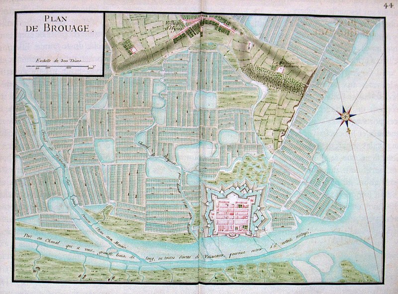
| Map of Brouage harbour | |||||
|---|---|---|---|---|---|
| Artist |
Unknown |
||||
| Title |
Map of Brouage harbour |
||||
| Date | 17th century | ||||
| Collection | Service historique de la Défense, Bibliothèque centrale de la Marine | ||||
| Accession number |
SH n76 |
||||
| Source/Photographer | Neptunia n°263, septembre 2011 | ||||
| Permission (Reusing this file) |
|
||||
File history
Click on a date/time to view the file as it appeared at that time.
| Date/Time | Thumbnail | Dimensions | User | Comment | |
|---|---|---|---|---|---|
| current | 09:08, 23 June 2012 | | 3,443 × 2,544 (2.31 MB) | Rama (talk | contribs) | {{Artwork |artist={{Langswitch |en=Unknown |fr=Inconnu }} |title={{Langswitch |en=Map of Brouage harbour |fr=Plan de Brouage }} |description= |date={{other date|century|17}} |medium= |dimensions= |institution=Service historique de la Défense, Biblioth... |
You cannot overwrite this file.
File usage on Commons
The following page uses this file: