File:Brueacre junction - geograph.org.uk - 1039839.jpg
No higher resolution available.
Brueacre_junction_-_geograph.org.uk_-_1039839.jpg (640 × 596 pixels, file size: 62 KB, MIME type: image/jpeg)
Captions
Captions
Add a one-line explanation of what this file represents
Summary edit
| Description |
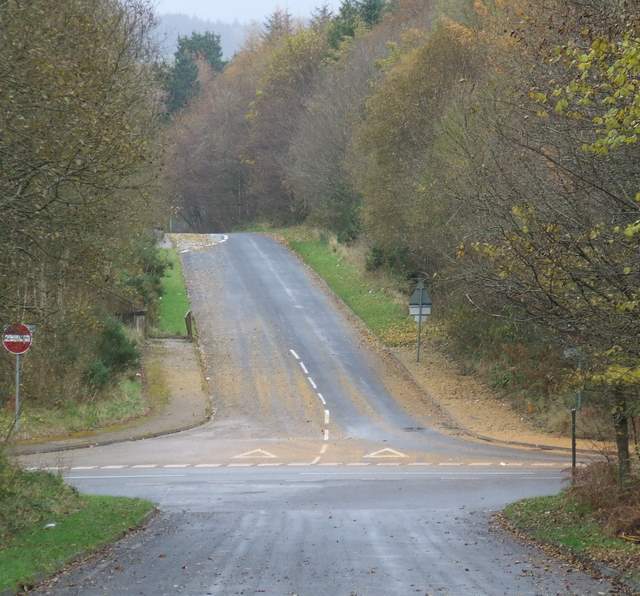
English: Brueacre junction The distant slip road leads from the southbound lane of the A78 at Inverkip Power Station. The junction was built to serve the power station in the early 1970s, but the power station was rarely used and is now awaiting demolition. The junction now serves the "Hill Farm" housing estates which continue to grow despite much local opposition. |
| Date | |
| Source | From geograph.org.uk |
| Author | Thomas Nugent |
| Attribution (required by the license) | Thomas Nugent / Brueacre junction / |
| Camera location | | View this and other nearby images on: OpenStreetMap |
|---|
_heading:22.00&language=en)
| Object location | | View this and other nearby images on: OpenStreetMap |
|---|
_heading:22.00&language=en)
Licensing edit

|
This image was taken from the Geograph project collection. See this photograph's page on the Geograph website for the photographer's contact details. The copyright on this image is owned by Thomas Nugent and is licensed for reuse under the Creative Commons Attribution-ShareAlike 2.0 license.
|
This file is licensed under the Creative Commons Attribution-Share Alike 2.0 Generic license.
Attribution: Thomas Nugent
- You are free:
- to share – to copy, distribute and transmit the work
- to remix – to adapt the work
- Under the following conditions:
- attribution – You must give appropriate credit, provide a link to the license, and indicate if changes were made. You may do so in any reasonable manner, but not in any way that suggests the licensor endorses you or your use.
- share alike – If you remix, transform, or build upon the material, you must distribute your contributions under the same or compatible license as the original.
File history
Click on a date/time to view the file as it appeared at that time.
| Date/Time | Thumbnail | Dimensions | User | Comment | |
|---|---|---|---|---|---|
| current | 17:21, 23 February 2011 | | 640 × 596 (62 KB) | GeographBot (talk | contribs) | == {{int:filedesc}} == {{Information |description={{en|1=Brueacre junction The distant slip road leads from the southbound lane of the A78 at Inverkip Power Station. The junction was built to serve the power station in the early 1970s, but the power stati |
You cannot overwrite this file.
File usage on Commons
There are no pages that use this file.