File:Bukowsko (gmina) location map.png

Original file (1,827 × 2,142 pixels, file size: 625 KB, MIME type: image/png)
Captions
Captions
Summary edit
_location_map.png&action=edit§ion=1)
| Description |
English: Location map |
| Date | |
| Source | Own work |
| Author | Smat |
| Description |
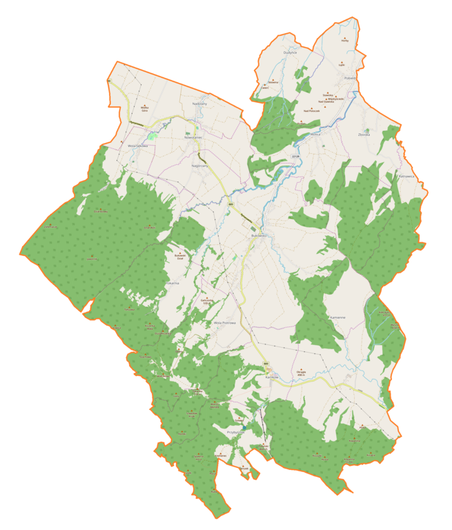
Polski: Mapa gminy Bukowsko, Polska
English: Map of Bukowsko (gmina), Poland |
|||||||||
| Date | ||||||||||
| Source | You may find a page on the OpenStreetMap wiki page for Bukowsko (gmina) | |||||||||
| Creator |
OpenStreetMap contributors OpenStreetMap contributors |
|||||||||
| Permission (Reusing this file) |
OpenStreetMap data is available under the Open Database License (details). Map tiles are licensed under the Creative Commons Attribution-ShareAlike 2.0 license (CC-BY-SA 2.0).
This file is licensed under the Creative Commons Attribution-Share Alike 2.0 Generic license.
|
|||||||||
| Geotemporal data | ||||||||||
| Bounding box |
|
|||||||||
| Georeferencing | If inappropriate please set warp_status = skip to hide. | |||||||||
Licensing edit
_location_map.png&action=edit§ion=2)
| This work contains information from OpenStreetMap, which is made available under the Open Database License (ODbL).
The ODbL does not require any particular license for maps produced from ODbL data. Prior to 1 August 2020, map tiles produced by the OpenStreetMap Foundation were licensed under the CC-BY-SA-2.0 license. Maps produced by other people may be subject to other licences. |
File history
Click on a date/time to view the file as it appeared at that time.
| Date/Time | Thumbnail | Dimensions | User | Comment | |
|---|---|---|---|---|---|
| current | 11:48, 28 August 2018 | | 1,827 × 2,142 (625 KB) | Smat (talk | contribs) | User created page with UploadWizard |
You cannot overwrite this file.
File usage on Commons
There are no pages that use this file.
File usage on other wikis
The following other wikis use this file:
- Usage on pl.wikipedia.org
- Nowotaniec
- Bukowsko
- Bełchówka
- Kamienne
- Płonna (województwo podkarpackie)
- Nadolany
- Wygnanka (Nadolany)
- Nagórzany (województwo podkarpackie)
- Przybyszów (województwo podkarpackie)
- Wola Jaworowa
- Zboiska (powiat sanocki)
- Dudyńce
- Karlików
- Wola Sękowa
- Wola Piotrowa
- Pobiedno
- Tokarnia (województwo podkarpackie)
- Wolica (powiat sanocki)
- Ratnawica
- Parafia św. Mikołaja w Nowotańcu
- Parafia Wszystkich Świętych w Dudyńcach
- Zamek w Nowotańcu
- Parafia Podwyższenia Krzyża Świętego w Bukowsku
- Cmentarz żydowski w Bukowsku
- Cmentarz w Nowotańcu
- Cerkiew św. św. Piotra i Pawła w Nagórzanach
- Farma Wiatrowa Bukowsko-Nowotaniec
- Cerkiew Pokrowy Najświętszej Maryi Panny w Płonnej
- Cmentarz żydowski w Nowotańcu
- Kościół św. Mikołaja w Nowotańcu
- Dwór w Woli Sękowej
- Kościół Podwyższenia Krzyża Świętego w Bukowsku
- Moduł:Mapa/dane/Bukowsko (gmina)
- Kościół Wszystkich Świętych w Dudyńcach
- Cerkiew Świętych Apostołów Piotra i Pawła w Wolicy
- Usage on pl.wikibooks.org
_location_map.png&oldid=837657032)