File:Burnt wheat field in Odesa region, 2023-07-17 (1).jpg

Size of this preview: 800 × 599 pixels. Other resolutions: 320 × 240 pixels | 640 × 479 pixels | 1,024 × 767 pixels | 1,280 × 959 pixels | 2,048 × 1,534 pixels.
Original file (2,048 × 1,534 pixels, file size: 421 KB, MIME type: image/jpeg)
Captions
Captions
Add a one-line explanation of what this file represents
Summary
edit.jpg&action=edit§ion=1)
| Description |
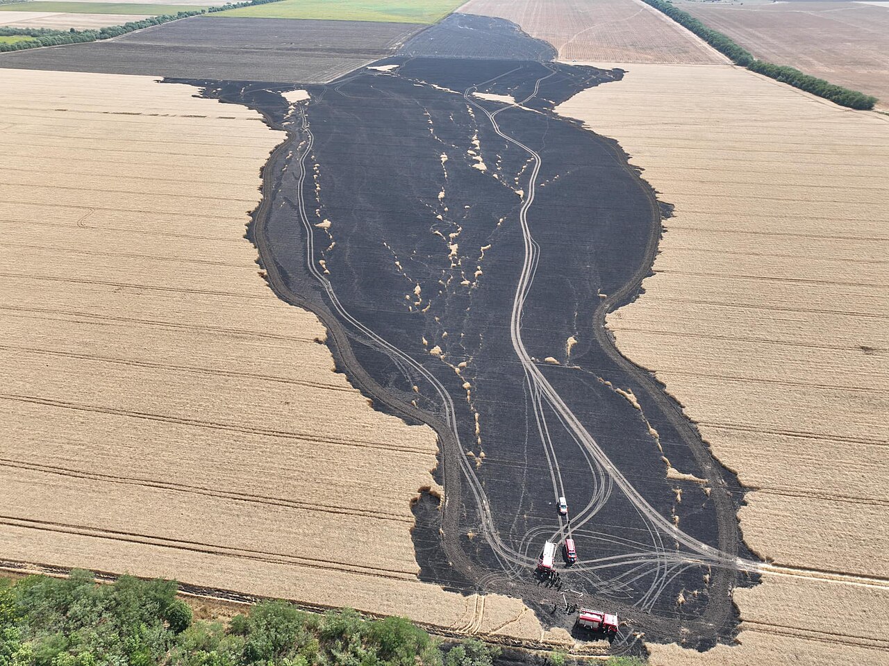
Русский: Выгоревшее пшеничное поле около села Великий Дальник в Одесской области.
English: Burnt wheat field near Velykyi Dalnyk village in Odesa region of Ukraine.
Українська: Original description: Близько 10 га поля з пшеницею знищено на Одещині Сьогодні зранку за межами села Великий Дальник в Одеському районі сталося загорання поля. Внаслідок поривів вітру вогонь швидко розповсюджувався. |
| Date | |
| Source | Одеський район: знищено близько 10 ГА поля з пшеницею (on Facebook, with high resolution) |
| Author | State Emergency Service of Ukraine |
Licensing
edit.jpg&action=edit§ion=2)
 |
This file comes from the website or social media of the State Emergency Service of Ukraine and is licensed under the Creative Commons Attribution 4.0 International License.
In short: you are free to distribute and modify the file as long as you attribute dsns.gov.ua.
|
This file is licensed under the Creative Commons Attribution 4.0 International license.
Attribution: Dsns.gov.ua
- You are free:
- to share – to copy, distribute and transmit the work
- to remix – to adapt the work
- Under the following conditions:
- attribution – You must give appropriate credit, provide a link to the license, and indicate if changes were made. You may do so in any reasonable manner, but not in any way that suggests the licensor endorses you or your use.
File history
Click on a date/time to view the file as it appeared at that time.
| Date/Time | Thumbnail | Dimensions | User | Comment | |
|---|---|---|---|---|---|
| current | 23:06, 19 July 2023 | | 2,048 × 1,534 (421 KB) | Sneeuwschaap (talk | contribs) | better resolution |
| 22:56, 19 July 2023 |  | 1,024 × 767 (157 KB) | Sneeuwschaap (talk | contribs) | Uploaded a work by State Emergency Service of Ukraine from [https://od.dsns.gov.ua/uk/pres-centr/news/nadzvicaini-podiyi/odeskii-raion-znishheno-blizko-10-ga-polia-z-pseniceiu Одеський район: знищено близько 10 ГА поля з пшеницею] ([https://www.facebook.com/DSNSODE/posts/pfbid0bquKbiYdQKF5ssdgjyN1PTdZ5vARvTBrSK21jrqvF8JvEzRe6Q8N36oWSokWS5zEl on Facebook]) with UploadWizard |
You cannot overwrite this file.
File usage on Commons
There are no pages that use this file.
.jpg&oldid=839435213)