File:Burrard-Inlet-map-en 2.svg

Size of this PNG preview of this SVG file: 728 × 519 pixels. Other resolutions: 320 × 228 pixels | 640 × 456 pixels | 1,024 × 730 pixels | 1,280 × 913 pixels | 2,560 × 1,825 pixels.
Original file (SVG file, nominally 728 × 519 pixels, file size: 268 KB)
Captions
Captions
Add a one-line explanation of what this file represents
Summary
edit
| Description |
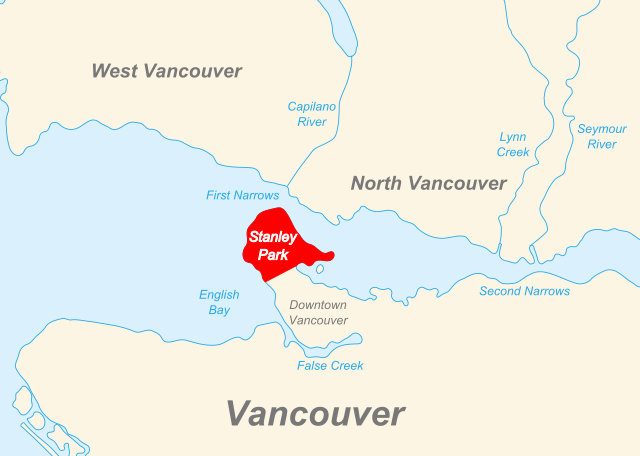
English: Map shows a large section of Burrard Inlet. Stanley Park is indicated in red. |
| Date | |
| Source | File:Burrard-Inlet-map-en.svg User: Themightyquill |
| Author | derivative work by User: rhild |
Licensing
edit
This file is licensed under the Creative Commons Attribution-Share Alike 3.0 Unported, 2.5 Generic, 2.0 Generic and 1.0 Generic license.
- You are free:
- to share – to copy, distribute and transmit the work
- to remix – to adapt the work
- Under the following conditions:
- attribution – You must give appropriate credit, provide a link to the license, and indicate if changes were made. You may do so in any reasonable manner, but not in any way that suggests the licensor endorses you or your use.
- share alike – If you remix, transform, or build upon the material, you must distribute your contributions under the same or compatible license as the original.
File history
Click on a date/time to view the file as it appeared at that time.
| Date/Time | Thumbnail | Dimensions | User | Comment | |
|---|---|---|---|---|---|
| current | 20:17, 8 November 2013 | | 728 × 519 (268 KB) | Rhild (talk | contribs) | Made the park name a bit bigger so it can be read at 200px. |
| 19:59, 8 November 2013 |  | 728 × 519 (268 KB) | Rhild (talk | contribs) | User created page with UploadWizard |
You cannot overwrite this file.
File usage on Commons
There are no pages that use this file.
File usage on other wikis
The following other wikis use this file:
- Usage on en.wikipedia.org
- Usage on fr.wikipedia.org
- Usage on nl.wikipedia.org
- Usage on pl.wikivoyage.org
- Usage on vi.wikipedia.org