File:Bushey unparished area UK locator map.svg

Size of this PNG preview of this SVG file: 625 × 600 pixels. Other resolutions: 250 × 240 pixels | 500 × 480 pixels | 800 × 768 pixels | 1,067 × 1,024 pixels | 2,134 × 2,048 pixels | 1,319 × 1,266 pixels.
Original file (SVG file, nominally 1,319 × 1,266 pixels, file size: 177 KB)
Captions
Captions
Add a one-line explanation of what this file represents
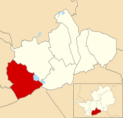
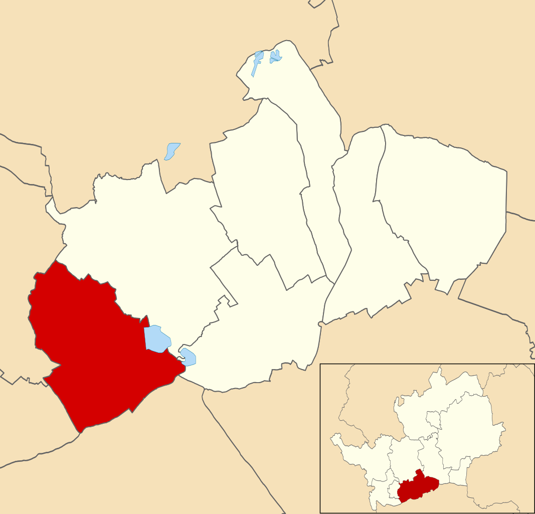
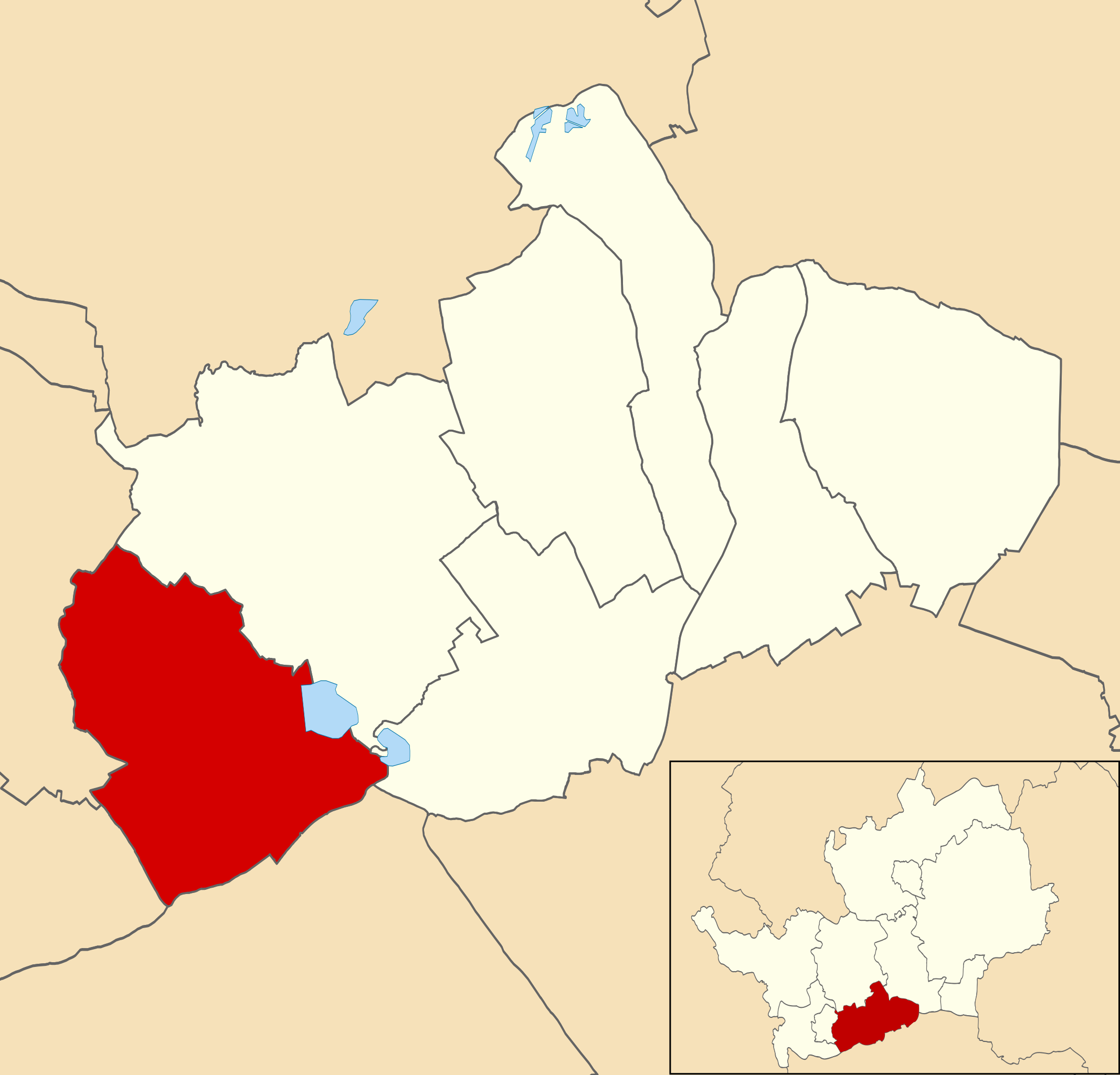
| Description | Map of Hertsmere, Hertfordshire, UK with the unparished area of Bushey highlighted. |
| Date | |
| Source |
|
| Author | Nilfanion, created using Ordnance Survey data |
| Permission (Reusing this file) |
This file is licensed under the Creative Commons Attribution-Share Alike 3.0 Unported license. Attribution: Contains Ordnance Survey data © Crown copyright and database right
|
File history
Click on a date/time to view the file as it appeared at that time.
| Date/Time | Thumbnail | Dimensions | User | Comment | |
|---|---|---|---|---|---|
| current | 19:49, 31 October 2015 | | 1,319 × 1,266 (177 KB) | Nilfanion (talk | contribs) | {{Information |Description=Map of Hertsmere, Hertfordshire, UK with the unparished area of Bushey highlighted. |Source=Ordnance Survey [https://www.ordnancesurvey.co.uk/opendatadownload/products.html OpenData]. *Coastline and admi... |
You cannot overwrite this file.
File usage on Commons
The following 2 pages use this file: