File:CGWAVE Tedious Creek MD.jpg
Size of this preview: 800 × 531 pixels. Other resolutions: 320 × 212 pixels | 640 × 424 pixels | 980 × 650 pixels.
Original file (980 × 650 pixels, file size: 236 KB, MIME type: image/jpeg)
Captions
Captions
Add a one-line explanation of what this file represents
Summary edit
| Description |
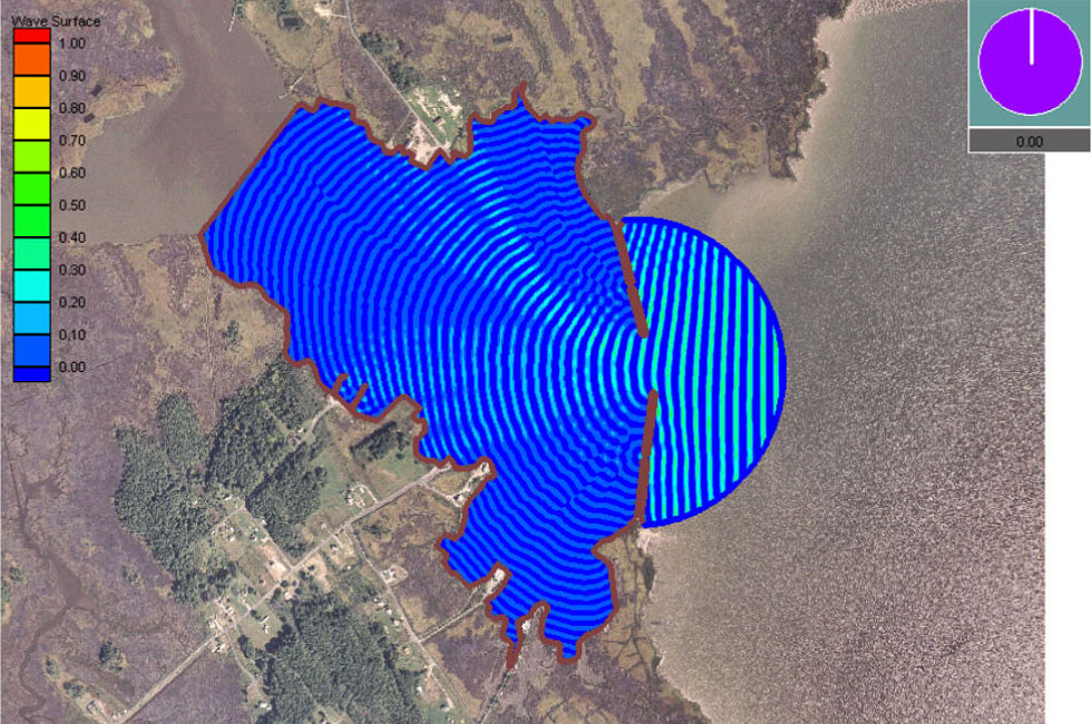
English: Simulation of wave penetration – involving diffraction and refraction – into Tedious Creek, Maryland, using CGWAVE (which solves the mild-slope equation). |
| Date | |
| Source | http://chl.erdc.usace.army.mil/Images%5C7%5C9%5C3%5Ccgwave_ani-tedious1.jpg |
| Author | Coastal & Hydraulics Laboratory, US Army Corps of Engineers |
| Object location | | View this and other nearby images on: OpenStreetMap |
|---|
Licensing edit
This file is a work of a U.S. Army soldier or employee, taken or made as part of that person's official duties. As a work of the U.S. federal government, it is in the public domain in the United States.
|
 |
File history
Click on a date/time to view the file as it appeared at that time.
| Date/Time | Thumbnail | Dimensions | User | Comment | |
|---|---|---|---|---|---|
| current | 20:17, 6 March 2011 | | 980 × 650 (236 KB) | Kraaiennest (talk | contribs) | {{Information |Description ={{en|1=Simulation of wave penetration – involving diffraction and refraction – into Tedious Creek, Maryland, using CGWAVE which solves the [[:en:mild slope equation|mild slope equat |
You cannot overwrite this file.
File usage on Commons
There are no pages that use this file.
File usage on other wikis
The following other wikis use this file:
- Usage on en.wikipedia.org
- Usage on es.wikipedia.org
- Usage on uk.wikipedia.org