File:CG 360d Nakatsuyama kofun.gif

Size of this preview: 800 × 464 pixels. Other resolutions: 320 × 186 pixels | 640 × 371 pixels | 1,280 × 742 pixels.
Original file (1,280 × 742 pixels, file size: 4.23 MB, MIME type: image/gif, looped, 72 frames, 7.2 s)
Captions
Captions
Add a one-line explanation of what this file represents
Summary edit
| Description |
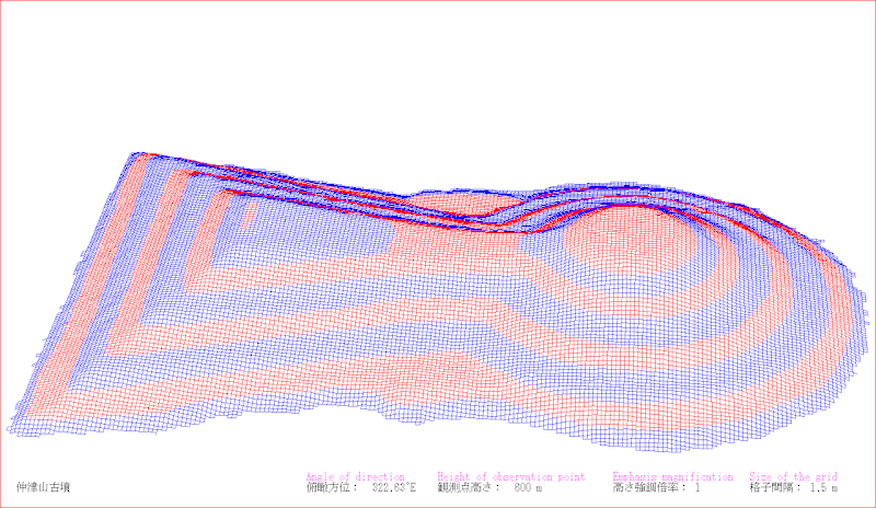
English: I who am a contributor drew the picture by a software which developed by myself.
The survey map which I referred to depends on "「仲姫命陵古墳」『古市古墳群測量図集成』古市古墳群世界文化遺産登録推進連絡会議(羽曳野市・藤井寺市) (2015年)". This is a drawing of present situation (not a drawing of a restored mound). The drawing depends on combination of wire frame and height eight phases classification. Perspective projection.日本語: 投稿者が自ら開発したソフトウェアで描画。
参照した測量図は、「仲姫命陵古墳」『古市古墳群測量図集成』古市古墳群世界文化遺産登録推進連絡会議(羽曳野市・藤井寺市) (2015年)による。 この図は現況図である(復元図ではない)。 描画は、ワイヤーフレームと高さ8段階色分けの併用による。透視投影。 |
| Date | |
| Source | Own work |
| Author | 名古屋太郎 |
Licensing edit
I, the copyright holder of this work, hereby publish it under the following licenses:
This file is licensed under the Creative Commons Attribution-Share Alike 4.0 International, 3.0 Unported, 2.5 Generic, 2.0 Generic and 1.0 Generic license.
- You are free:
- to share – to copy, distribute and transmit the work
- to remix – to adapt the work
- Under the following conditions:
- attribution – You must give appropriate credit, provide a link to the license, and indicate if changes were made. You may do so in any reasonable manner, but not in any way that suggests the licensor endorses you or your use.
- share alike – If you remix, transform, or build upon the material, you must distribute your contributions under the same or compatible license as the original.

|
Permission is granted to copy, distribute and/or modify this document under the terms of the GNU Free Documentation License, Version 1.2 or any later version published by the Free Software Foundation; with no Invariant Sections, no Front-Cover Texts, and no Back-Cover Texts. A copy of the license is included in the section entitled GNU Free Documentation License. |
You may select the license of your choice.
File history
Click on a date/time to view the file as it appeared at that time.
| Date/Time | Thumbnail | Dimensions | User | Comment | |
|---|---|---|---|---|---|
| current | 08:58, 9 September 2017 | | 1,280 × 742 (4.23 MB) | 名古屋太郎 (talk | contribs) | {{Information |Description ={{en|1=I who am a contributor drew the picture by a software which developed by myself. The survey map which I referred to depends on "「仲姫命陵古墳」『古市古墳群測量図集成』古市古墳群世界文... |
You cannot overwrite this file.
File usage on Commons
There are no pages that use this file.
File usage on other wikis
The following other wikis use this file:
- Usage on hr.wikipedia.org
- Usage on sl.wikipedia.org