File:CORONA, Istanbul 1964.png

Size of this preview: 800 × 207 pixels. Other resolutions: 320 × 83 pixels | 640 × 165 pixels | 1,024 × 264 pixels | 1,280 × 330 pixels | 2,560 × 661 pixels | 104,581 × 27,000 pixels.
Original file (104,581 × 27,000 pixels, file size: 289.81 MB, MIME type: image/png)
Captions
Captions
Add a one-line explanation of what this file represents
Summary
edit
| Warning | The original file is very high-resolution. It might not load properly or could cause your browser to freeze when opened at full size. |
|---|
| Description |
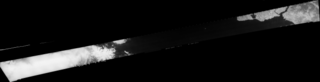
English: United States photographic surveillance program CORONA, Istanbul 1964 |
|||||||||
| Date | ||||||||||
| Source | https://corona.cast.uark.edu/atlas | |||||||||
| Creator |
CIA, DS&T, and USAF |
|||||||||
| Geotemporal data | ||||||||||
| Heading |
 |
|||||||||
| Bounding box |
|
|||||||||
| Georeferencing | If inappropriate please set warp_status = skip to hide. | |||||||||
| Other versions | ||||||||||
.png)
Licensing
edit
| This image is a work of a Central Intelligence Agency employee, taken or made as part of that person's official duties. As a Work of the United States Government, this image or media is in the public domain in the United States.
|

|
File history
Click on a date/time to view the file as it appeared at that time.
| Date/Time | Thumbnail | Dimensions | User | Comment | |
|---|---|---|---|---|---|
| current | 17:51, 3 January 2023 | 104,581 × 27,000 (289.81 MB) | ToprakM (talk | contribs) | Uploaded a work by CIA, DS&T, and USAF from https://corona.cast.uark.edu/atlas with UploadWizard |
You cannot overwrite this file.
File usage on Commons
The following 6 pages use this file: