File:Caen tram point.JPG

Size of this preview: 450 × 600 pixels. Other resolutions: 180 × 240 pixels | 360 × 480 pixels | 576 × 768 pixels | 768 × 1,024 pixels | 1,944 × 2,592 pixels.
Original file (1,944 × 2,592 pixels, file size: 1.72 MB, MIME type: image/jpeg)
Captions
Captions
Add a one-line explanation of what this file represents
| Description |
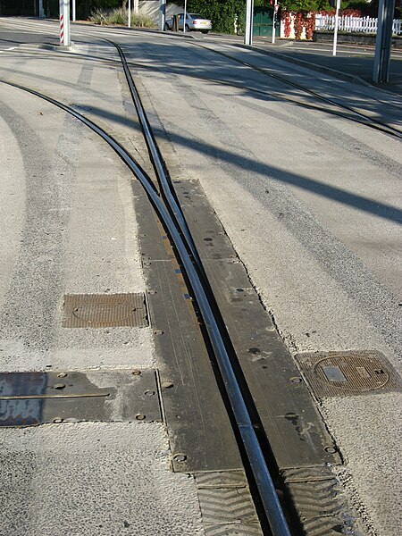
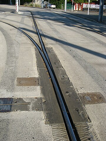
Čeština: Výměna výhybky na vodicí kolejnici ve Francii v Caen. Kolejnice není zátěžová, pouze vede zatáčecí nápravu. Přestavení směru se provádí podsunutím jazyku výměny pod krycí desky.
English: "Tram" point in Caen (France). There is a single guiding rail. The whole plate under the two rails moves to present the correct rail.
Français : Transport léger guidé deCaen - Bifurcation entre les lignes A et B à l'arrêt Copernic.
Nederlands: "Tram" wissel in Caen (Frankrijk). Is maar een gidsrail. De onderliggende plaat beweegt waarmee de rail op zijn plaats wordt gezet.
Русский: Стрелка «трамвая на шинах» в Кане, Франция. Рельс играет роль только направляющей, а не опоры для вагона. Перевод стрелки осуществляется путём переворота всей пластины под остряками. |
||
| Date | |||
| Source | Own work | ||
| Author | Smiley.toerist | ||
| Permission (Reusing this file) |
I, the copyright holder of this work, hereby publish it under the following licenses:
This file is licensed under the Creative Commons Attribution-Share Alike 3.0 Unported, 2.5 Generic, 2.0 Generic and 1.0 Generic license.
You may select the license of your choice. |

| Camera location | | View this and other nearby images on: OpenStreetMap |
|---|
File history
Click on a date/time to view the file as it appeared at that time.
| Date/Time | Thumbnail | Dimensions | User | Comment | |
|---|---|---|---|---|---|
| current | 10:58, 25 September 2008 | | 1,944 × 2,592 (1.72 MB) | Smiley.toerist (talk | contribs) | {{Information |Description={{en|1="Tram" point in Caen (France). Is a single guiding rail. The whole plate under the two rails moves to present the correct rail.}} {{nl|1="Tram" wissel in Caen (Frankrijk). Is maar een gidsrail. De onderliggende plaat bew |
You cannot overwrite this file.
File usage on Commons
The following page uses this file:
File usage on other wikis
The following other wikis use this file:
- Usage on fr.wikipedia.org
- Usage on hr.wikipedia.org
- Usage on it.wikipedia.org
- Usage on ja.wikipedia.org
- Usage on nl.wikipedia.org