File:Caerleon end of cycleway - geograph.org.uk - 1755714.jpg
No higher resolution available.
Caerleon_end_of_cycleway_-_geograph.org.uk_-_1755714.jpg (640 × 480 pixels, file size: 80 KB, MIME type: image/jpeg)
Captions
Captions
Add a one-line explanation of what this file represents
Summary edit
| Description |
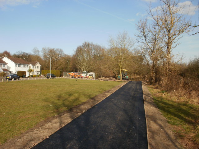
English: Caerleon end of cycleway The cycle route and footpath from Malpas ends adjacent to the southeast corner of Home Farm Crescent. Road surfacing vehicles are parked here for the weekend. On Monday, they will resume their work on the few remaining unsurfaced parts of the cycleway close to the Malpas end, about 1.5 kilometres away.
The cycleway is expected to be opened officially in April 2010. |
| Date | |
| Source | From geograph.org.uk |
| Author | John Grayson |
| Camera location | | View this and other nearby images on: OpenStreetMap |
|---|
_heading:67.00&language=en)
| Object location | | View this and other nearby images on: OpenStreetMap |
|---|
_heading:67.00&language=en)
Licensing edit

|
This image was taken from the Geograph project collection. See this photograph's page on the Geograph website for the photographer's contact details. The copyright on this image is owned by John Grayson and is licensed for reuse under the Creative Commons Attribution-ShareAlike 2.0 license.
|
This file is licensed under the Creative Commons Attribution-Share Alike 2.0 Generic license.
Attribution: John Grayson
- You are free:
- to share – to copy, distribute and transmit the work
- to remix – to adapt the work
- Under the following conditions:
- attribution – You must give appropriate credit, provide a link to the license, and indicate if changes were made. You may do so in any reasonable manner, but not in any way that suggests the licensor endorses you or your use.
- share alike – If you remix, transform, or build upon the material, you must distribute your contributions under the same or compatible license as the original.
File history
Click on a date/time to view the file as it appeared at that time.
| Date/Time | Thumbnail | Dimensions | User | Comment | |
|---|---|---|---|---|---|
| current | 22:13, 5 March 2011 | | 640 × 480 (80 KB) | GeographBot (talk | contribs) | == {{int:filedesc}} == {{Information |description={{en|1=Caerleon end of cycleway The cycle route and footpath from Malpas ends adjacent to the southeast corner of Home Farm Crescent. Road surfacing vehicles are parked here for the weekend. On Monday, the |
You cannot overwrite this file.
File usage on Commons
There are no pages that use this file.