File:Cairn de l'île Carn plan.png
Size of this preview: 673 × 600 pixels. Other resolutions: 269 × 240 pixels | 538 × 480 pixels | 862 × 768 pixels | 1,149 × 1,024 pixels | 2,360 × 2,104 pixels.
Original file (2,360 × 2,104 pixels, file size: 144 KB, MIME type: image/png)
Captions
Captions
Add a one-line explanation of what this file represents
Summary edit
| Description |
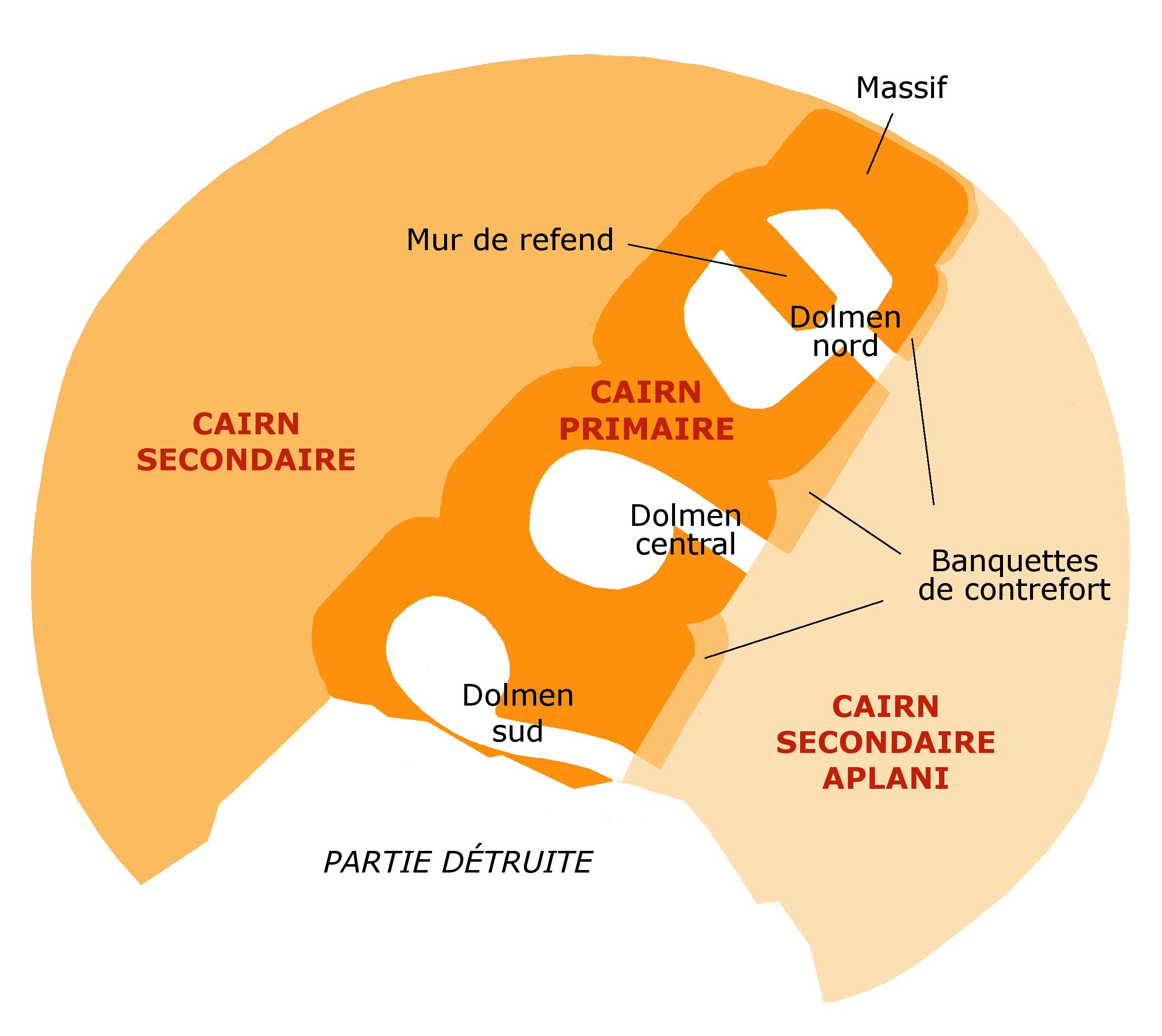
Français : Plan approximatif du cairn de l'île Carn, en Ploudalmézeau, au nord du Bas-Léon, Finistère, Bretagne. Ne cherchant qu'à faire comprendre l'organisation de ce cairn, je me suis inspiré, mais grossièrement, sans respect des formes ni des proportions, de 3 croquis de Pierre-Roland Giot, planches C2, C2' et C2" de Barnenez, Carn, Guennoc, Université de Rennes I, 1987, t. II. |
| Date | |
| Source | Own work |
| Author | Uuetenava |
Licensing edit
I, the copyright holder of this work, hereby publish it under the following license:
This file is licensed under the Creative Commons Attribution-Share Alike 4.0 International license.
- You are free:
- to share – to copy, distribute and transmit the work
- to remix – to adapt the work
- Under the following conditions:
- attribution – You must give appropriate credit, provide a link to the license, and indicate if changes were made. You may do so in any reasonable manner, but not in any way that suggests the licensor endorses you or your use.
- share alike – If you remix, transform, or build upon the material, you must distribute your contributions under the same or compatible license as the original.
File history
Click on a date/time to view the file as it appeared at that time.
| Date/Time | Thumbnail | Dimensions | User | Comment | |
|---|---|---|---|---|---|
| current | 13:51, 12 May 2017 | | 2,360 × 2,104 (144 KB) | Uuetenava (talk | contribs) | changé couleurs |
| 21:37, 18 December 2014 |  | 2,360 × 2,104 (153 KB) | Uuetenava (talk | contribs) | User created page with UploadWizard |
You cannot overwrite this file.
File usage on Commons
The following page uses this file:
File usage on other wikis
The following other wikis use this file:
- Usage on de.wikipedia.org
- Usage on fr.wikipedia.org