File:California Central Valley county map.svg

Size of this PNG preview of this SVG file: 508 × 600 pixels. Other resolutions: 203 × 240 pixels | 407 × 480 pixels | 651 × 768 pixels | 867 × 1,024 pixels | 1,735 × 2,048 pixels | 621 × 733 pixels.
Original file (SVG file, nominally 621 × 733 pixels, file size: 504 KB)
Captions
Captions
Add a one-line explanation of what this file represents
Summary edit
| Description |
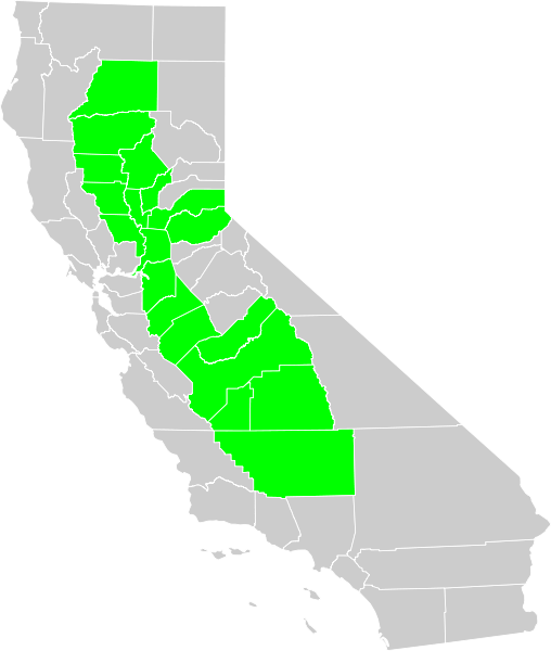
Political map of California displaying in green Central Valley of California counties.
|
| Date | |
| Source | Own work based on: Blank California Map.svg |
| Author | Thadius856 |
| SVG development |
Licensing edit
| I, the copyright holder of this work, release this work into the public domain. This applies worldwide. In some countries this may not be legally possible; if so: I grant anyone the right to use this work for any purpose, without any conditions, unless such conditions are required by law. |
File history
Click on a date/time to view the file as it appeared at that time.
| Date/Time | Thumbnail | Dimensions | User | Comment | |
|---|---|---|---|---|---|
| current | 01:48, 25 December 2007 | | 621 × 733 (504 KB) | Thadius856 (talk | contribs) | {{Information |Description=Political map of California displaying Central Valley counties. Made from Census map in PD. Category:Maps of California |Source=Self-made. Inspired by Image:California CentralValley county map.png |Date= December 24, 2 |
You cannot overwrite this file.
File usage on Commons
The following 2 pages use this file:
File usage on other wikis
The following other wikis use this file:
- Usage on ast.wikipedia.org
- Usage on ca.wikipedia.org
- Usage on el.wikipedia.org
- Usage on en.wikipedia.org
- Usage on eo.wikipedia.org
- Usage on eu.wikipedia.org
- Usage on hu.wikipedia.org
- Usage on jv.wikipedia.org
- Usage on tr.wikipedia.org
- Usage on vi.wikipedia.org
- Usage on www.wikidata.org
- Usage on zh.wikipedia.org