File:California county map.svg
Original file(SVG file, nominally 512 × 857 pixels, file size: 706 KB)

Captions

Captions

Add a one-line explanation of what this file represents

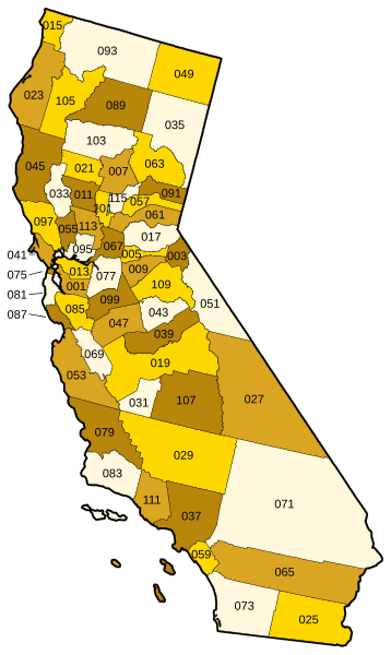
Vector map of California showing state and county borders. Derived from a US Census publication. Numbered using FIPS subcode (see en:List of counties in California.)

 
The SVG code is valid.
 
This vector image was created with Inkscape, and then manually edited
.


Public domain
This image or file is a work of a United States Census Bureau employee, taken or made as part of that person's official duties. As a work of the U.S. federal government, the image is in the public domain.

English  español  日本語  македонски  മലയാളം  português do Brasil  русский  українська  +/−


derivative works edit

Derivative works of this file:  California counties outline map.svg

File history

Click on a date/time to view the file as it appeared at that time.

Date/TimeThumbnailDimensionsUserComment
current21:01, 21 September 2006Thumbnail for version as of 21:01, 21 September 2006512 × 857 (706 KB)Tintazul (talk | contribs)County map corrected and coloured, with FIPS subcode
19:09, 2 January 2006Thumbnail for version as of 19:09, 2 January 200694 × 160 (706 KB)Fastfission~commonswiki (talk | contribs)Vector map of California showing state and county borders. Derived from a US Census publication. {{PD-USGov-DOC-Census}} Category:Maps of California

File usage on other wikis

The following other wikis use this file: