File:Calle de las Infantas nº 40-42 (Madrid) 02.jpg
Size of this preview: 775 × 599 pixels. Other resolutions: 311 × 240 pixels | 621 × 480 pixels | 993 × 768 pixels | 1,280 × 990 pixels | 2,560 × 1,980 pixels | 3,683 × 2,848 pixels.
Original file (3,683 × 2,848 pixels, file size: 2.19 MB, MIME type: image/jpeg)
Captions
Captions
Add a one-line explanation of what this file represents
| Description |
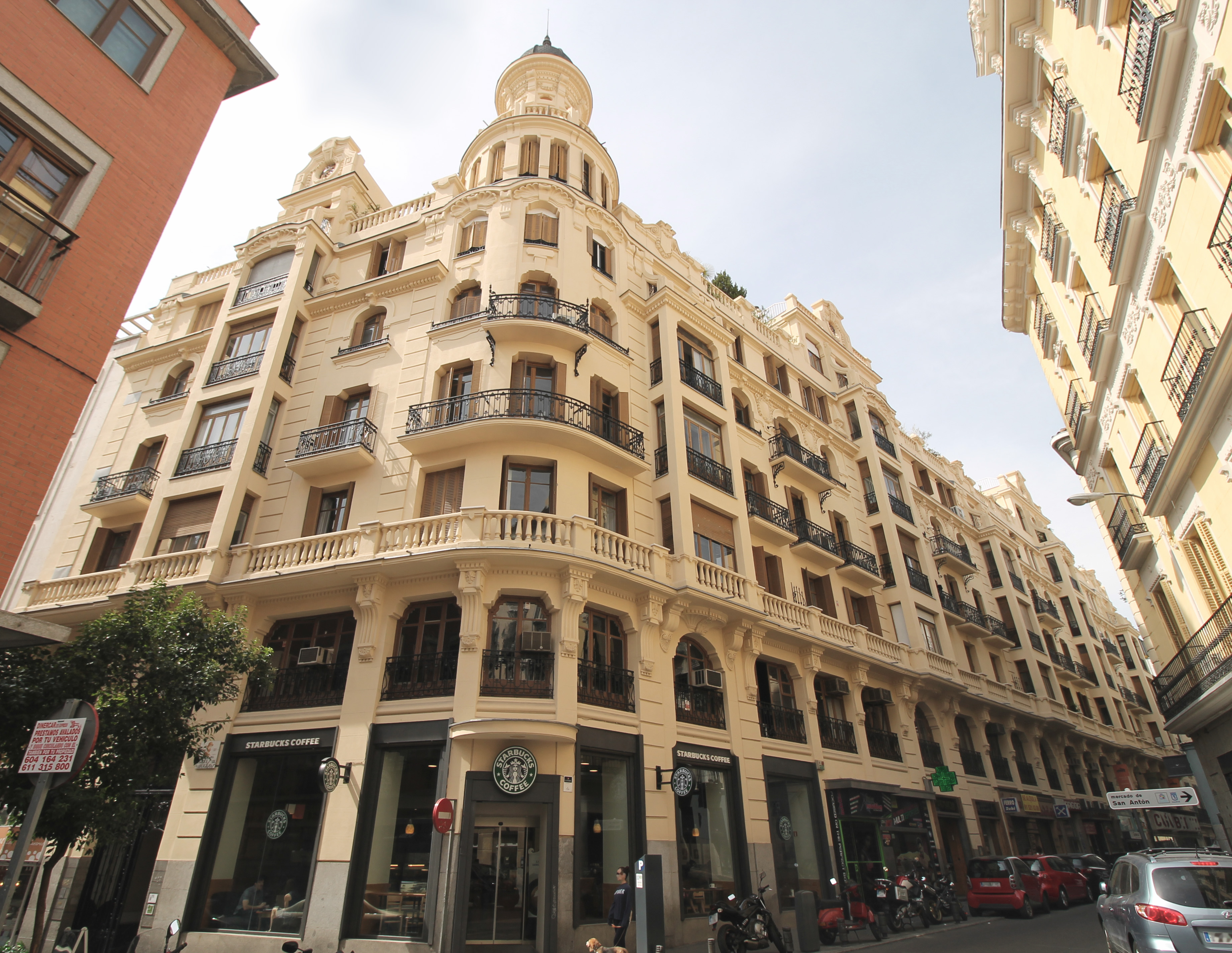
English: Housing designed in 1922 by architect Eduardo Sánchez Eznarriaga for Mr. Rafael Sánchez and built between 1922 and 1926. Writer Enrique Jardiel Poncela lived in it from 1939 until his death in 1952.
Español: Edificio de viviendas proyectado en 1922 por el arquitecto Eduardo Sánchez Eznarriaga para D. Rafael Sánchez y construido entre 1922 y 1926. El escritor Enrique Jardiel Poncela vivió en él desde 1939 hasta su muerte en 1952.
| ||
| Address |
|
||
| Date | |||
| Source | Own work | ||
| Author | Luis García (Zaqarbal) | ||
| Permission (Reusing this file) |
I, the copyright holder of this work, hereby publish it under the following licenses:
This file is licensed under the Creative Commons Attribution-Share Alike 3.0 Spain license. Attribution: Luis García
 You may select the license of your choice. |
||
| Other versions |
_01.jpg) |

| Object location | | View this and other nearby images on: OpenStreetMap |
|---|
_02.jpg¶ms=040.419956_N_-003.697332_E_globe:Earth_class:object_type:landmark_region:ES_&language=en)
File history
Click on a date/time to view the file as it appeared at that time.
| Date/Time | Thumbnail | Dimensions | User | Comment | |
|---|---|---|---|---|---|
| current | 00:41, 10 September 2015 | | 3,683 × 2,848 (2.19 MB) | Zaqarbal (talk | contribs) | Photo taken by Luis García (Zaqarbal) on September 9th, 2015. Hereby published under GFDL and Cc-by-sa-3.0-ES licenses. |
You cannot overwrite this file.
File usage on Commons
The following 2 pages use this file:
File usage on other wikis
The following other wikis use this file:
- Usage on es.wikipedia.org
_02.jpg&oldid=846102974)