File:Cammas Hall Farm track White Roding Marks Hall Lane, Essex England 1.jpg
Size of this preview: 800 × 562 pixels. Other resolutions: 320 × 225 pixels | 640 × 449 pixels | 1,024 × 719 pixels | 1,280 × 899 pixels | 2,560 × 1,797 pixels | 5,925 × 4,160 pixels.
Original file (5,925 × 4,160 pixels, file size: 29.07 MB, MIME type: image/jpeg)
Captions
Captions
Add a one-line explanation of what this file represents
Summary
edit| Description |
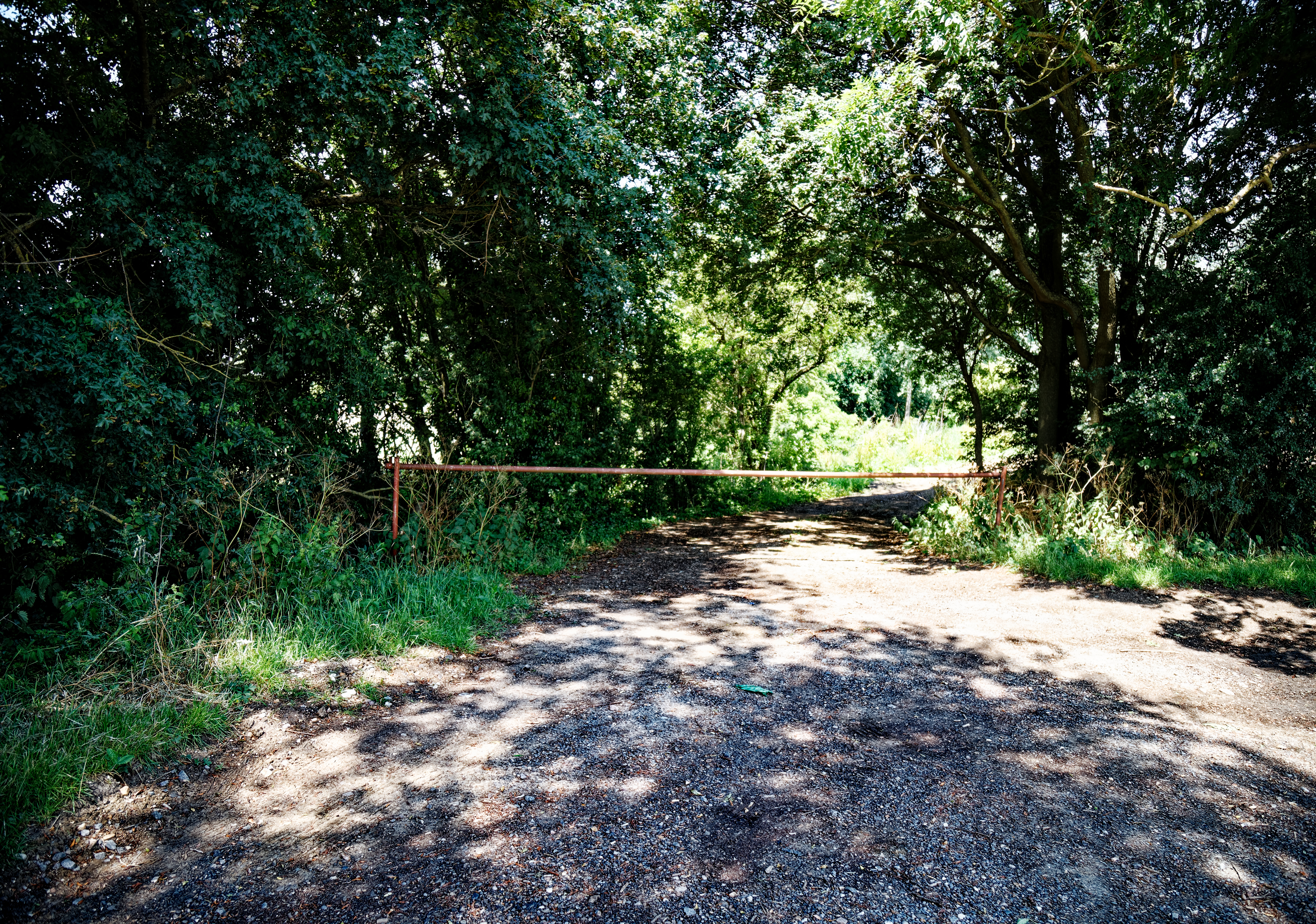
Farm track entrance to Cammas Hall Farm on Marks Hall Lane to the north of White Roding village, part of The Rodings in west Essex, England. Cammas (or Cames) Hall was the centre of the parish and manor of Morrell Roding, which by the 19th century had become a township of White Roding, and today fully absorbed in White Roding parish. Cammas Hall's manor of Morrell Roding is listed in the Domesday Book; White Roding is not. Mobile device view: Wikimedia (June 2020) makes it difficult to immediately view photo groups related to this image. To see its most relevant allied photos, click on White Roding, and this uploader's Photos. You can add a click-through 'categories' button to the very bottom of photo-pages you view by going to settings... three-bar icon top left. Desktop view: Wikimedia (June 2020) makes it difficult to immediately view the helpful category links where you can find images related to this one in a variety of ways; for these go to the very bottom of the page. This image is one of a series of date and/or subject allied consecutive photographs kept in progression or location by file name number and/or time marking. Camera: Canon EOS 6D Mark II with Canon EF 24-105mm F4L IS USM lens. Software: File lens-corrected, optimized, perhaps cropped, with DxO OpticsPro Elite, and likely further optimized with Adobe Photoshop CS2. |
||||||||||
| Date | |||||||||||
| Source | Own work | ||||||||||
| Author | Acabashi | ||||||||||
| Permission (Reusing this file) |
Attribution: Image © Acabashi CC-BY-SA 4.0.
I, the copyright holder of this work, hereby publish it under the following license: This file is licensed under the Creative Commons Attribution-Share Alike 4.0 International license.
|

File history
Click on a date/time to view the file as it appeared at that time.
| Date/Time | Thumbnail | Dimensions | User | Comment | |
|---|---|---|---|---|---|
| current | 17:34, 27 June 2020 | | 5,925 × 4,160 (29.07 MB) | Acabashi (talk | contribs) |
You cannot overwrite this file.
File usage on Commons
There are no pages that use this file.