File:Camp Mather 2012 map.jpg

Size of this preview: 455 × 599 pixels. Other resolutions: 182 × 240 pixels | 364 × 480 pixels | 583 × 768 pixels | 778 × 1,024 pixels | 1,555 × 2,048 pixels | 5,085 × 6,695 pixels.
Original file (5,085 × 6,695 pixels, file size: 2.78 MB, MIME type: image/jpeg)
Captions
Captions
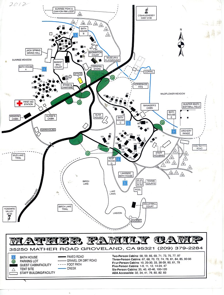
Camp Mather map 2012
Summary
edit
| Description |
English: Camp Mather Map 2012
note that campsites 1 to 9 were moved south about a decade later drawing from City of San Francisco, image by M. Von der Porten public domain |
| Date | |
| Source | Own work |
| Author | MikeVdP |
Licensing
edit
I, the copyright holder of this work, hereby publish it under the following license:
This file is licensed under the Creative Commons Attribution-Share Alike 4.0 International license.
- You are free:
- to share – to copy, distribute and transmit the work
- to remix – to adapt the work
- Under the following conditions:
- attribution – You must give appropriate credit, provide a link to the license, and indicate if changes were made. You may do so in any reasonable manner, but not in any way that suggests the licensor endorses you or your use.
- share alike – If you remix, transform, or build upon the material, you must distribute your contributions under the same or compatible license as the original.
File history
Click on a date/time to view the file as it appeared at that time.
| Date/Time | Thumbnail | Dimensions | User | Comment | |
|---|---|---|---|---|---|
| current | 16:03, 8 August 2022 | | 5,085 × 6,695 (2.78 MB) | MikeVdP (talk | contribs) | Uploaded own work with UploadWizard |
You cannot overwrite this file.
File usage on Commons
There are no pages that use this file.