File:Canada marine transportation infrastructure 2006 harbours map.png

Size of this preview: 669 × 600 pixels. Other resolutions: 268 × 240 pixels | 536 × 480 pixels | 857 × 768 pixels | 1,143 × 1,024 pixels | 2,285 × 2,048 pixels | 6,879 × 6,165 pixels.
Original file (6,879 × 6,165 pixels, file size: 15.15 MB, MIME type: image/png)
Captions
Captions
Add a one-line explanation of what this file represents
| Description |
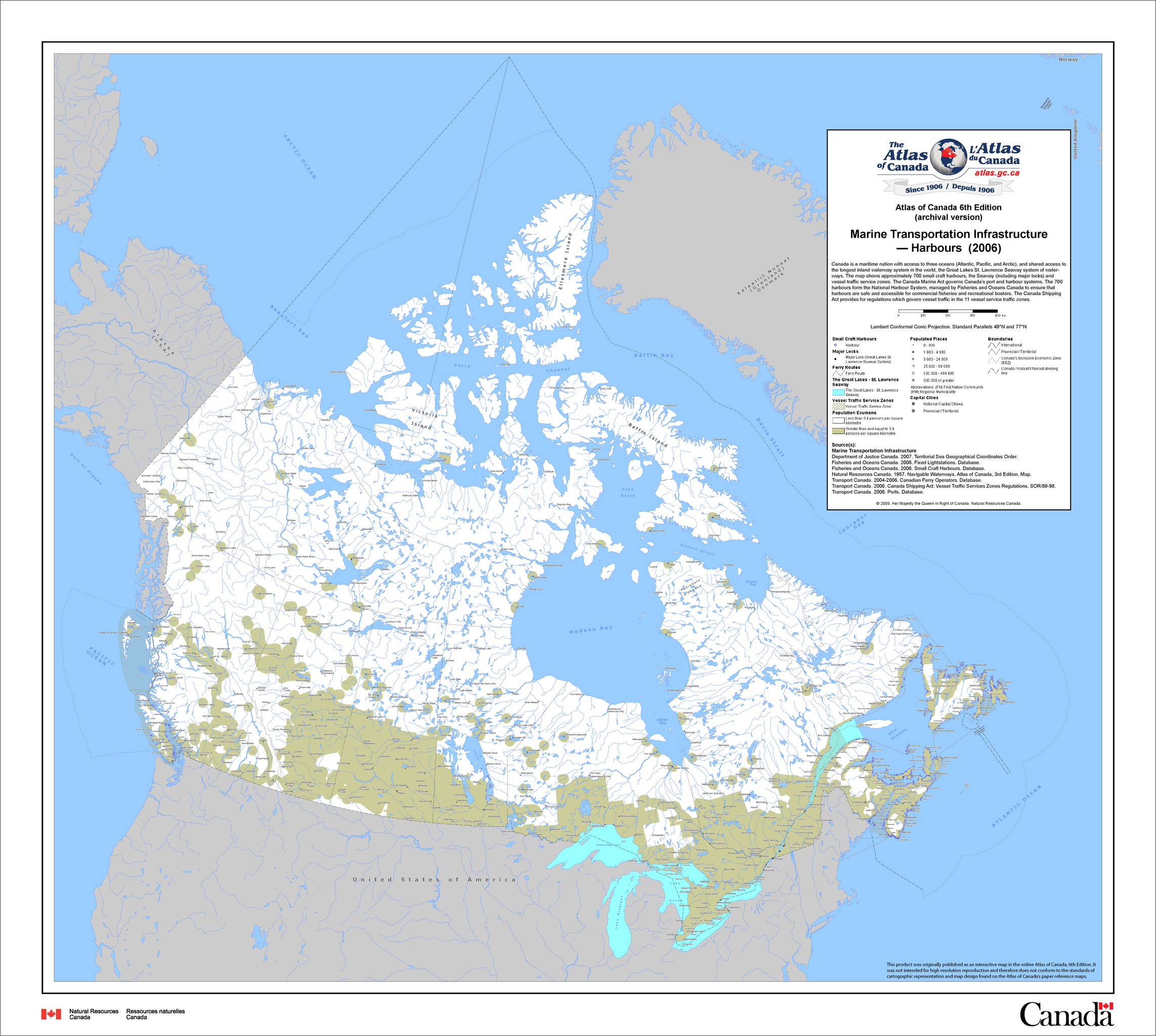
English: Converted to PNG by the uploader. The map shows approximately 590 major ports, the Seaway (including major locks) and vessel traffic service zones. The Canada Marine Act governs Canada’s port and harbour systems. The ports, comprising the National Port System, have been classified into three major types: Canada Port Authorities (CPAs), regional/local ports and remote ports. The largest ports are the 19 CPAs and 1 harbour commission (Oshawa), recognized by the Federal government as vital to domestic and international trade. The Canada Shipping Act provides for regulations which govern vessel traffic in the 11 vessel service traffic zones. |
|||||
| Date | ||||||
| Source | Extracted from the zip file here: http://data.gc.ca/data/en/dataset/d6c5280f-8893-11e0-988d-6cf049291510 (now: https://open.canada.ca/data/en/dataset/d6e61d8f-8893-11e0-b987-6cf049291510) | |||||
| Author | Natural Resources Canada | |||||
| Permission (Reusing this file) |
|
.svg)
File history
Click on a date/time to view the file as it appeared at that time.
| Date/Time | Thumbnail | Dimensions | User | Comment | |
|---|---|---|---|---|---|
| current | 22:12, 5 January 2014 | | 6,879 × 6,165 (15.15 MB) | Oaktree b (talk | contribs) | {{Information |Description ={{en|1=Converted to PNG by the uploader. The map shows approximately 590 major ports, the Seaway (including major locks) and vessel traffic service zones. The Canada Marine Act governs Canada’s port and harbour systems.... |
You cannot overwrite this file.
File usage on Commons
There are no pages that use this file.