File:Canadian Arctic.jpg
Size of this preview: 373 × 599 pixels. Other resolutions: 149 × 240 pixels | 299 × 480 pixels | 478 × 768 pixels | 637 × 1,024 pixels | 1,512 × 2,428 pixels.
Original file (1,512 × 2,428 pixels, file size: 1.63 MB, MIME type: image/jpeg)
Captions
Captions
Add a one-line explanation of what this file represents
Summary edit
| Canadian Arctic | |
|---|---|
| Photographer |
Envisat satellite |
| Title |
Canadian Arctic |
| Description |
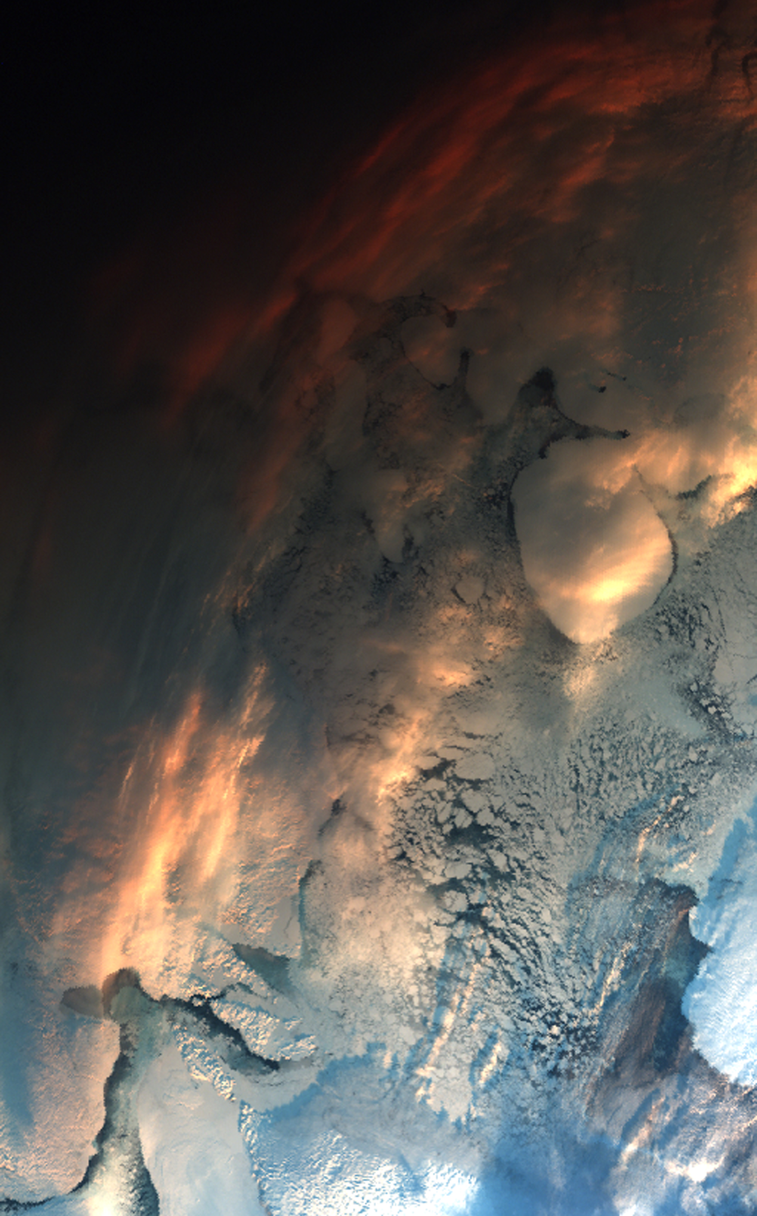
English: This Envisat image shows the snow-covered Nunavut territory in the Canadian Arctic. The icy body of water is Fox Basin, a shallow extension of the Atlantic Ocean. Due to the low elevation of the sun at this time of the year, the top of the image appears very dark. The position of the low sun gives the clouds in the upper part of the image a reddish tint.
The Advanced Along Track Scanning Radiometer (AATSR) acquired this image on 2 December 2009. AATSR, one of the 10 instruments on Envisat, has a visible-light imaging capability for land surfaces and atmospheric clouds and aerosols. |
| Depicted place | Foxe Basin |
| Date | 2 December 2009 |
| Collection | European Space Agency |
| Accession number |
232484 |
| Credit line | ESA |
| Source | http://www.esa.int/spaceinimages/Images/2009/12/Canadian_Arctic |
Licensing edit
This file is licensed under the Creative Commons Attribution-ShareAlike 3.0 IGO license.
- You are free:
- to share – to copy, distribute and transmit the work
- to remix – to adapt the work
- Under the following conditions:
- attribution – You must give appropriate credit, provide a link to the license, and indicate if changes were made. You may do so in any reasonable manner, but not in any way that suggests the licensor endorses you or your use.
- share alike – If you remix, transform, or build upon the material, you must distribute your contributions under the same or compatible license as the original.
File history
Click on a date/time to view the file as it appeared at that time.
| Date/Time | Thumbnail | Dimensions | User | Comment | |
|---|---|---|---|---|---|
| current | 10:47, 27 February 2017 | | 1,512 × 2,428 (1.63 MB) | Revent (talk | contribs) | =={{int:filedesc}}== {{Photograph |photographer = Envisat satellite |title = Canadian Arctic |description = {{en|1=This Envisat image shows the snow-covered Nunavut territory in the Canadian Arctic. The icy body of water is... |
You cannot overwrite this file.
File usage on Commons
The following 4 pages use this file: