File:Cape Independence, language, voting patterns and ethnicity.svg

Size of this PNG preview of this SVG file: 686 × 599 pixels. Other resolutions: 275 × 240 pixels | 550 × 480 pixels | 880 × 768 pixels | 1,173 × 1,024 pixels | 2,346 × 2,048 pixels.
Original file (SVG file, nominally 686 × 599 pixels, file size: 3.68 MB)
Captions
Captions
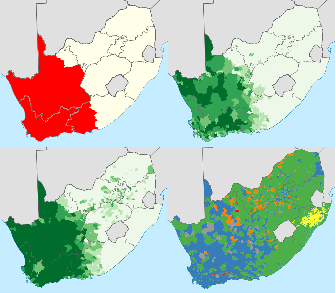
Maps (from top left in clockwise order) of often include cape independence municipalities, 'Coloureds' as a percentage of the population, largest party in voting districts in the 2019 elections and percentage of Afrikaans speakers at home.
Summary edit
| Description |
English: Four maps from top left in clockwise order:
Municipalities often included in the Cape Independence movement
'Coloured' people as a proportion of the total population in each region: 0–20%
20–40%
40–60%
60–80%
80–100%
The party with the largest number of votes in each voting district: Other party
Tie between two or more parties Proportion of the population that speaks Afrikaans at home: 0–20%
20–40%
40–60%
60–80%
80–100% |
| Source | |
| Author |
|date=2021-08-18 |source=Own work |author=Htonl,Suffy69 }}
Licensing edit
I, the copyright holder of this work, hereby publish it under the following license:
This file is licensed under the Creative Commons Attribution-Share Alike 4.0 International license.
- You are free:
- to share – to copy, distribute and transmit the work
- to remix – to adapt the work
- Under the following conditions:
- attribution – You must give appropriate credit, provide a link to the license, and indicate if changes were made. You may do so in any reasonable manner, but not in any way that suggests the licensor endorses you or your use.
- share alike – If you remix, transform, or build upon the material, you must distribute your contributions under the same or compatible license as the original.
File history
Click on a date/time to view the file as it appeared at that time.
| Date/Time | Thumbnail | Dimensions | User | Comment | |
|---|---|---|---|---|---|
| current | 16:11, 30 August 2021 | | 686 × 599 (3.68 MB) | Suffy69 (talk | contribs) | Correct canvas scaling |
| 15:57, 30 August 2021 |  | 744 × 1,052 (3.67 MB) | Suffy69 (talk | contribs) | Clean version, no municipalities shown | |
| 14:37, 18 August 2021 |  | 809 × 709 (4.6 MB) | Suffy69 (talk | contribs) | Cross-wiki upload from en.wikipedia.org |
You cannot overwrite this file.
File usage on Commons
There are no pages that use this file.
File usage on other wikis
The following other wikis use this file:
- Usage on en.wikipedia.org
- Usage on fr.wikipedia.org
- Usage on nl.wikipedia.org
- Usage on zh.wikipedia.org