File:Cape May Map.svg

Size of this PNG preview of this SVG file: 512 × 370 pixels. Other resolutions: 320 × 231 pixels | 640 × 463 pixels | 1,024 × 740 pixels | 1,280 × 925 pixels | 2,560 × 1,850 pixels.
Original file (SVG file, nominally 512 × 370 pixels, file size: 976 KB)
Captions
Captions
Add a one-line explanation of what this file represents
Summary edit
| Description |
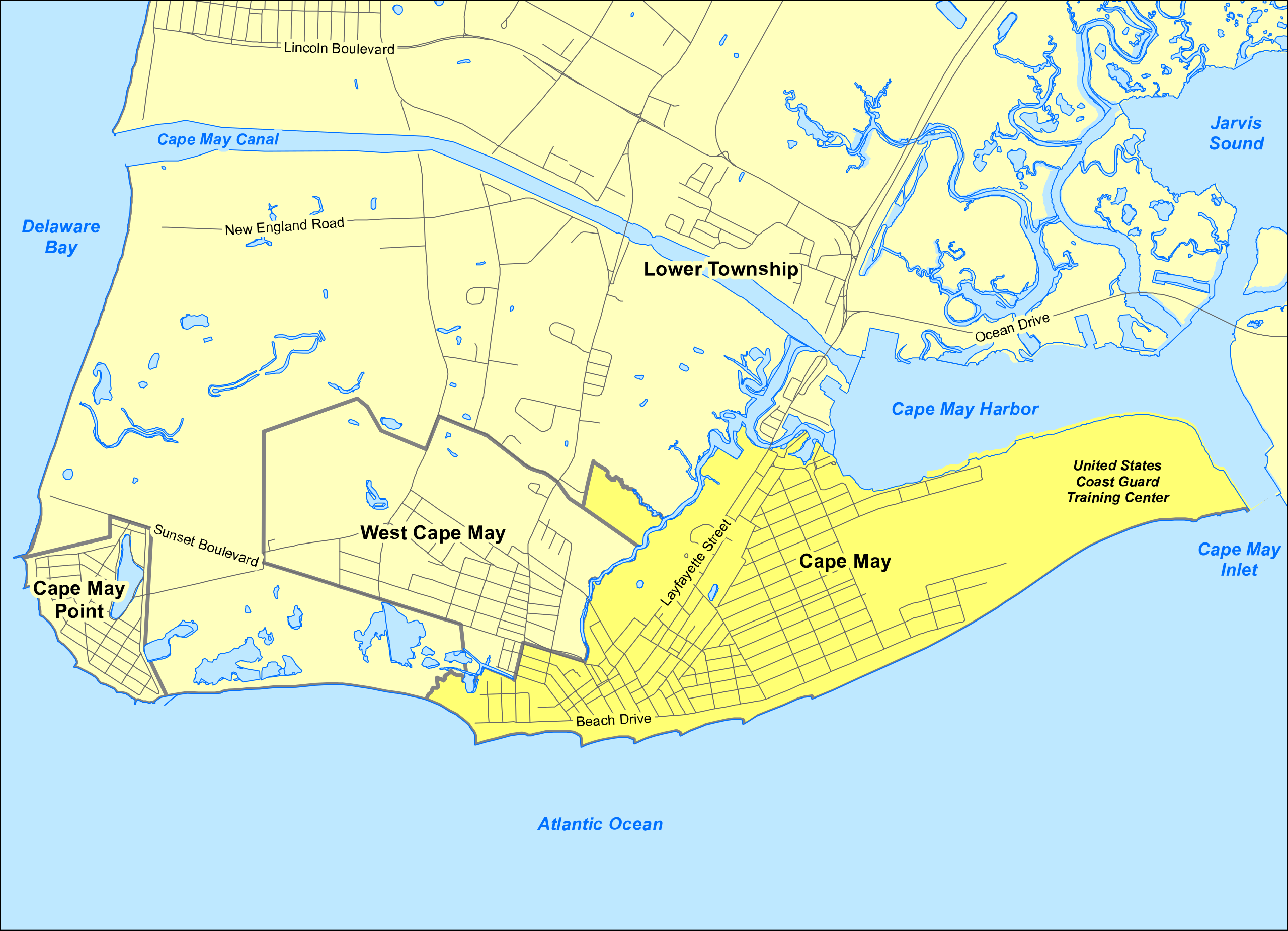
English: Map project is NAD 83 State Plane New Jersey, feet.
Data came from the New Jersey Geographic Information Network (https://njgin.state.nj.us/NJ_NJGINExplorer/DataDownloads.jsp) as well as from the NJ National Hydro Dataset (http://www.nj.gov/dep/gis/nhd2002.html). Used data from the Census Bureau, Google Earth, and Esri just for cross checking what was showing up and labeling. |
| Date | |
| Source | Not published. Emailed to me for posting by author. |
| Author | Blake Hathaway Mailhes |
| Permission (Reusing this file) |
Licensing edit
This file is licensed under the Creative Commons Attribution-Share Alike 4.0 International license.
- You are free:
- to share – to copy, distribute and transmit the work
- to remix – to adapt the work
- Under the following conditions:
- attribution – You must give appropriate credit, provide a link to the license, and indicate if changes were made. You may do so in any reasonable manner, but not in any way that suggests the licensor endorses you or your use.
- share alike – If you remix, transform, or build upon the material, you must distribute your contributions under the same or compatible license as the original.
File history
Click on a date/time to view the file as it appeared at that time.
| Date/Time | Thumbnail | Dimensions | User | Comment | |
|---|---|---|---|---|---|
| current | 20:53, 1 September 2015 | | 512 × 370 (976 KB) | Munion (talk | contribs) | User created page with UploadWizard |
You cannot overwrite this file.
File usage on Commons
There are no pages that use this file.
File usage on other wikis
The following other wikis use this file:
- Usage on azb.wikipedia.org
- Usage on en.wikipedia.org
- Usage on pa.wikipedia.org