File:Cape farewell greenland landsat.jpg
Size of this preview: 800 × 593 pixels. Other resolutions: 320 × 237 pixels | 640 × 474 pixels | 1,024 × 758 pixels | 1,280 × 948 pixels.
Original file (1,280 × 948 pixels, file size: 246 KB, MIME type: image/jpeg)
Captions
Captions
Add a one-line explanation of what this file represents
Summary edit
| Description |
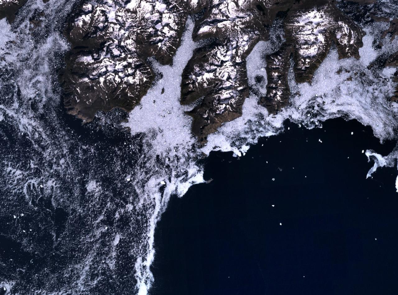
English: Cape Farewell (the centre of the image) and the rugged southern coast of Egger Island, The coast (dark) is generally surrounded by sea ice, making navigation treacherous.
Español: Cabo Farewell (en el centro de la imagen) y la escarpada costa sur de la isla de Egger. La costa (oscura) está generalmente rodeada por un mar helado, haciendo la navegación traicionera.
Français : Cap Farvel (au centre de l'image) et la rude côte sud de l'île Egger. La côte (en foncé) est généralement entourée par une mer de glace, rendant la navigation dangereuse.
Íslenska: Hvarf (fyrir miðri mynd) og suðurströnd Egger-eyju. Eins og sjá má hér er hafið út af Hvarfi oftast fullt af hafís.
Lietuvių: Farvelo kyšulys (nuotraukos viduryje) ir raižyta Egerio salos pakrantė. Krantas yra apsuptas ledo lyčių, dėl to navigacija šioje vietoje yra sudėtinga.
Svenska: Kap Farvel (mitten) på satellitbild.
中文:法韦尔角在图片中心位置. |
| Date | |
| Source | English Wikipedia |
| Author |
Licensing edit
| This file is in the public domain in the United States because it was solely created by NASA. NASA copyright policy states that "NASA material is not protected by copyright unless noted". (See Template:PD-USGov, NASA copyright policy page or JPL Image Use Policy.) | ||
 |
Warnings:
|
File history
Click on a date/time to view the file as it appeared at that time.
| Date/Time | Thumbnail | Dimensions | User | Comment | |
|---|---|---|---|---|---|
| current | 20:43, 5 October 2006 | | 1,280 × 948 (246 KB) | Masae~commonswiki (talk | contribs) | {{Information |Description= |Source=English Wikipedia |Date=5 October 2006 |Author= |Permission= |other_versions= }} |
You cannot overwrite this file.
File usage on Commons
There are no pages that use this file.
File usage on other wikis
The following other wikis use this file:
- Usage on ca.wikipedia.org
- Usage on ceb.wikipedia.org
- Usage on cs.wikipedia.org
- Usage on cy.wikipedia.org
- Usage on de.wikipedia.org
- Usage on el.wikipedia.org
- Usage on en.wikipedia.org
- Usage on es.wikipedia.org
- Usage on et.wikipedia.org
- Usage on eu.wikipedia.org
- Usage on fr.wikipedia.org
- Usage on fy.wikipedia.org
- Usage on ga.wikipedia.org
- Usage on he.wikipedia.org
- Usage on hu.wikipedia.org
- Usage on is.wikipedia.org
- Usage on it.wikipedia.org
- Usage on lt.wikipedia.org
- Usage on nl.wikipedia.org
- Usage on no.wikipedia.org
- Usage on olo.wikipedia.org
- Usage on pl.wikipedia.org
- Usage on pt.wikipedia.org
- Usage on se.wikipedia.org
- Usage on sv.wikipedia.org
- Usage on uk.wikipedia.org
- Usage on uz.wikipedia.org
- Usage on www.wikidata.org
- Usage on zh.wikipedia.org