File:Car Park for the South Tyne Trail (geograph 6419322).jpg
No higher resolution available.
Car_Park_for_the_South_Tyne_Trail_(geograph_6419322).jpg (640 × 480 pixels, file size: 108 KB, MIME type: image/jpeg)
Captions
Captions
Add a one-line explanation of what this file represents
Summary edit
.jpg&action=edit§ion=1)
| Description |
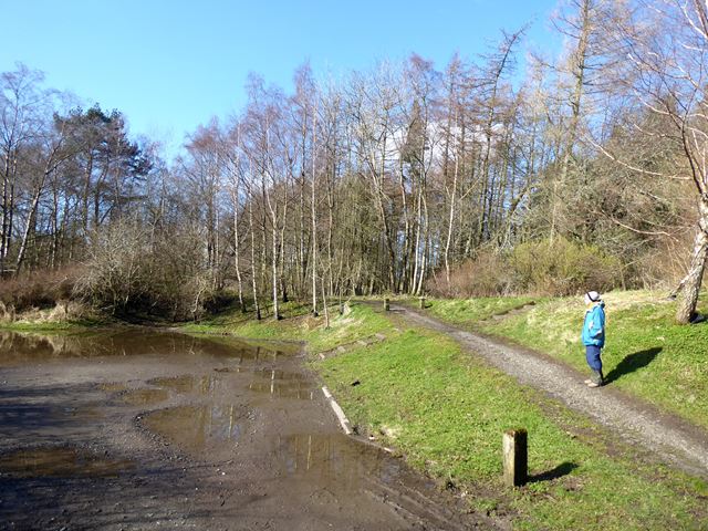
English: Car Park for the South Tyne Trail On the site of the former Featherstone Park Station. The South Tyne Trail follows the course of the former Haltwhistle to Alston railway, operational from 1851/2 to 1976. The railway path also forms part of National Cycle Network route 68 (Pennine Cycleway). |
| Date | |
| Source | From geograph.org.uk |
| Author | Oliver Dixon |
| Permission (Reusing this file) |
Creative Commons Attribution Share-alike license 2.0 |
| Attribution (required by the license) | Oliver Dixon / Car Park for the South Tyne Trail / |
| Camera location | | View this and other nearby images on: OpenStreetMap |
|---|
.jpg¶ms=054.940196_N_-002.497899_E_globe:Earth_type:camera_source:geograph-osgb36(NY6820060728)_heading:225.00&language=en)
| Object location | | View this and other nearby images on: OpenStreetMap |
|---|
.jpg¶ms=054.940030_N_-002.498210_E_globe:Earth_class:object_type:object_source:geograph-osgb36(NY68186071)_heading:225.00&language=en)
Licensing edit
.jpg&action=edit§ion=2)

|
This image was taken from the Geograph project collection. See this photograph's page on the Geograph website for the photographer's contact details. The copyright on this image is owned by Oliver Dixon and is licensed for reuse under the Creative Commons Attribution-ShareAlike 2.0 license.
|
This file is licensed under the Creative Commons Attribution-Share Alike 2.0 Generic license.
Attribution: Oliver Dixon
- You are free:
- to share – to copy, distribute and transmit the work
- to remix – to adapt the work
- Under the following conditions:
- attribution – You must give appropriate credit, provide a link to the license, and indicate if changes were made. You may do so in any reasonable manner, but not in any way that suggests the licensor endorses you or your use.
- share alike – If you remix, transform, or build upon the material, you must distribute your contributions under the same or compatible license as the original.
File history
Click on a date/time to view the file as it appeared at that time.
| Date/Time | Thumbnail | Dimensions | User | Comment | |
|---|---|---|---|---|---|
| current | 19:51, 5 November 2020 | | 640 × 480 (108 KB) | Lamberhurst (talk | contribs) | Transferred from geograph.co.uk using [https://tools.wmflabs.org/geograph2commons/ geograph2commons] |
You cannot overwrite this file.
File usage on Commons
The following page uses this file:
.jpg&oldid=848111270)