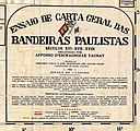
File:CartaGeralBandeirasPaulistas Taunay 1952.jpg

Original file (2,818 × 2,639 pixels, file size: 822 KB, MIME type: image/jpeg)
Captions
Captions
Summary edit
| DescriptionCartaGeralBandeirasPaulistas Taunay 1952.jpg |
English: Bandeiras Paulistas Map
Português: Carta Geral das Bandeiras Paulistas. Uma das primeiras iniciativas de Taunay quando assumiu a direção do Museu Paulista, em 1917, foi iniciar a coleta de documentos visuais e referências textuais que pudessem celebrar o passado sertanista. A concepção da sala Cartografia colonial e documentos antigos (Figura 1), vinculou-se diretamente com esse intento. Ali foi exposta a monumental Carta Geral das Bandeiras Paulistas, executada sob sua orientação e desenhada por Gregório Colás e José Domingues Santos Filho, cartógrafos do Museu Paulista, em escala de 1:5.500.000, em 1921. |
||
| Date | |||
| Source | TAUNAY, Afonso de E., 1926. Ensaio de Carta Geral das Bandeiras Paulistas. | ||
| Author | T AUNAY, Afonso de Escragnolle | ||
| Other versions |
|
Licensing edit
| This file is made available under the Creative Commons CC0 1.0 Universal Public Domain Dedication. | |
| The person who associated a work with this deed has dedicated the work to the public domain by waiving all of their rights to the work worldwide under copyright law, including all related and neighboring rights, to the extent allowed by law. You can copy, modify, distribute and perform the work, even for commercial purposes, all without asking permission.
http://creativecommons.org/publicdomain/zero/1.0/deed.enCC0Creative Commons Zero, Public Domain Dedicationfalsefalse |
File history
Click on a date/time to view the file as it appeared at that time.
| Date/Time | Thumbnail | Dimensions | User | Comment | |
|---|---|---|---|---|---|
| current | 17:04, 1 August 2020 |  | 2,818 × 2,639 (822 KB) | Paulo Selke (talk | contribs) | Uploaded a work by TAUNAY, Afonso de Escragnolle from TAUNAY, Afonso de E., 1926. Ensaio de Carta Geral das Bandeiras Paulistas. with UploadWizard |
You cannot overwrite this file.
File usage on Commons
The following 2 pages use this file:
File usage on other wikis
The following other wikis use this file:
- Usage on pt.wikipedia.org
- Usage on www.wikidata.org
Metadata
This file contains additional information such as Exif metadata which may have been added by the digital camera, scanner, or software program used to create or digitize it. If the file has been modified from its original state, some details such as the timestamp may not fully reflect those of the original file. The timestamp is only as accurate as the clock in the camera, and it may be completely wrong.
| Author | Taunay, Affonso de E. |
|---|---|
| Software used | Adobe Acrobat 11.0.7 |
| IIM version | 2 |
