File:Carta Del Monte Circeo e Circondarj di S. Felice.jpg

Size of this preview: 800 × 591 pixels. Other resolutions: 320 × 236 pixels | 640 × 473 pixels | 1,024 × 757 pixels | 1,280 × 946 pixels | 2,560 × 1,891 pixels | 7,327 × 5,413 pixels.
Original file (7,327 × 5,413 pixels, file size: 12.67 MB, MIME type: image/jpeg)
Captions
Captions
Add a one-line explanation of what this file represents
Summary
edit
| Description |
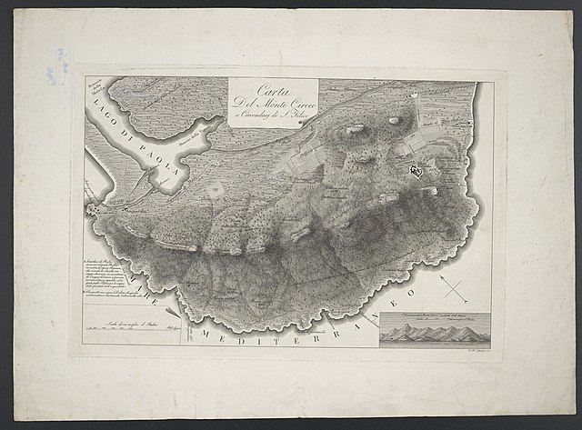
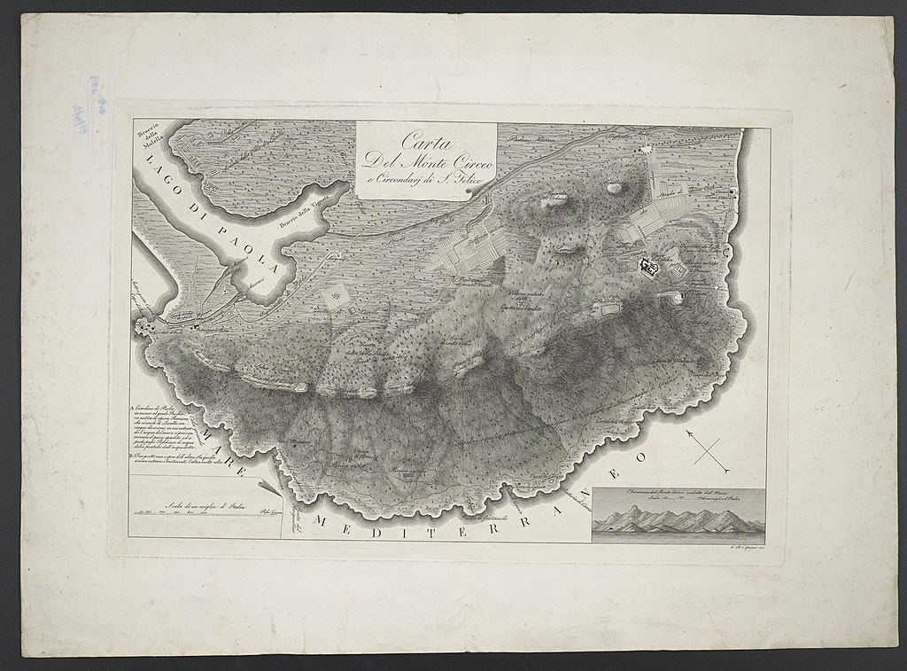
Deutsch: 1 Kt. : unkolor. (44 x 29 cm); Koordinaten E 13°01'59"-E 13°06'56"/N 41°16'13"-N 41°13'15"; Maßstab in graph. Form (Scala di un miglio d'Italia). - Titel oben Mitte. - Mit 1 Nebenkt.: Elevazione del Monte Circeo veduta dal Mare. - Relief: kräftige Schraffen |
| Date | circa 1800 |
| Source | Leibniz-Institut für Länderkunde, Leipzig |
| Author | Cipriani, Giovanni Battista |
Dargestellt sind der Berg Circeo und die Stadt San Felice Circeo
Licensing
edit
| This file is made available under the Creative Commons CC0 1.0 Universal Public Domain Dedication. | |
| The person who associated a work with this deed has dedicated the work to the public domain by waiving all of their rights to the work worldwide under copyright law, including all related and neighboring rights, to the extent allowed by law. You can copy, modify, distribute and perform the work, even for commercial purposes, all without asking permission.
|
File history
Click on a date/time to view the file as it appeared at that time.
| Date/Time | Thumbnail | Dimensions | User | Comment | |
|---|---|---|---|---|---|
| current | 09:26, 7 September 2018 | | 7,327 × 5,413 (12.67 MB) | Higgenhorscht (talk | contribs) | User created page with UploadWizard |
You cannot overwrite this file.
File usage on Commons
There are no pages that use this file.