File:Carta Geografica do Termo de Villa Rica.jpg

Size of this preview: 487 × 599 pixels. Other resolutions: 195 × 240 pixels | 390 × 480 pixels | 624 × 768 pixels | 832 × 1,024 pixels | 2,470 × 3,040 pixels.
Original file (2,470 × 3,040 pixels, file size: 1.49 MB, MIME type: image/jpeg)
Captions
Captions
Add a one-line explanation of what this file represents
Summary edit
| Description |
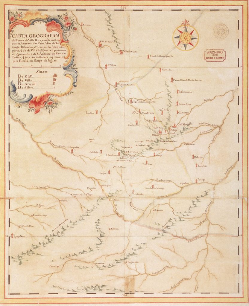
Português: "Carta Geografica do Termo de Villa Rica, em q' se mostra que os Arrayaes das Catas Altas da Noroega, Itaberava, e Carijós lhe ficam mais perto, q' ao da Villa de S. José a q' pertencem, e igualmente o de S. Antônio do Rio das Pedras, q' toca ao do Sabará, o q' se mostra, pelas Escalas ou Petipé de leguas." por Claudio Manoel da Costa |
| Date | circa 1766 |
| Source | COSTA, A. Gilberto da. Os Caminhos do Ouro e a Estrada Real, ed. UFMG (Belo Horizonte); Kapa Editorial (Lisboa), 2005 |
| Author | Cláudio Manuel da Costa (en) (Cláudio Manuel da Costa (pt) |
| Permission (Reusing this file) |
PD old |
Licensing edit
|
This work is in the public domain in its country of origin and other countries and areas where the copyright term is the author's life plus 100 years or fewer. This work is in the public domain in the United States because it was published (or registered with the U.S. Copyright Office) before January 1, 1929. | |
| This file has been identified as being free of known restrictions under copyright law, including all related and neighboring rights. | |
File history
Click on a date/time to view the file as it appeared at that time.
| Date/Time | Thumbnail | Dimensions | User | Comment | |
|---|---|---|---|---|---|
| current | 16:08, 29 April 2010 | | 2,470 × 3,040 (1.49 MB) | André Koehne (talk | contribs) | {{Information |Description={{pt|"''Carta Geografica do Termo de Villa Rica, em q' se mostra que os Arrayaes das Catas Altas da Noroega, Itaberava, e Carijós lhe ficam mais perto, q' ao da Villa de S. José a q' pertencem, e igualmente o de S. Antônio do |
You cannot overwrite this file.
File usage on Commons
There are no pages that use this file.