File:Carte 1ère circonscription Savoie.png

Size of this preview: 739 × 599 pixels. Other resolutions: 296 × 240 pixels | 592 × 480 pixels | 947 × 768 pixels | 1,263 × 1,024 pixels | 2,526 × 2,048 pixels | 4,676 × 3,792 pixels.
Original file (4,676 × 3,792 pixels, file size: 245 KB, MIME type: image/png)
Captions
Captions
Add a one-line explanation of what this file represents
Summary
edit
| Description |
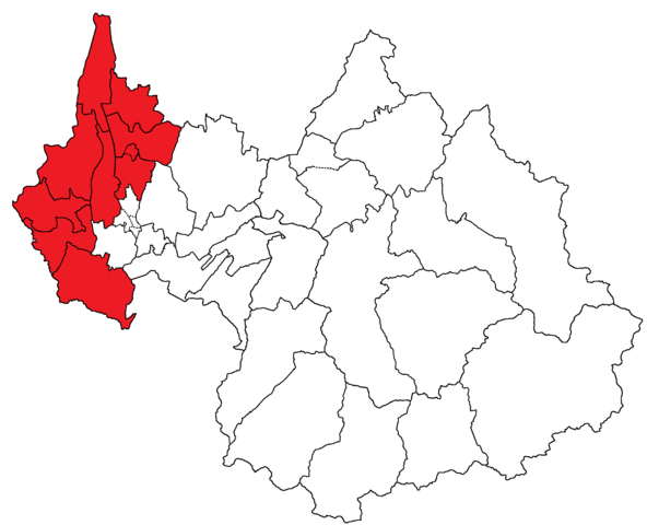
English: Map of the French department of Savoie. In red is the first electoral circonscription and its 10 cantons zones. Main city is Aix-les-Bains.
Français : Carte du département français de la Savoie. En rouge est représentée la première circonscription électorale et ses 10 cantons. La principale ville est Aix-les-Bains. |
||
| Date | |||
| Source | Own work | ||
| Author | Florian Pépellin | ||
| Permission (Reusing this file) |
|
||
| Other versions |
Circ. 2 = |
| Annotations | This image is annotated: View the annotations at Commons |
File history
Click on a date/time to view the file as it appeared at that time.
| Date/Time | Thumbnail | Dimensions | User | Comment | |
|---|---|---|---|---|---|
| current | 15:51, 9 June 2013 | | 4,676 × 3,792 (245 KB) | Floflo (talk | contribs) | {{Information |Description={{en|Map of the French department of Savoie. In red is the ''first electoral circonscription'' and its 10 ''cantons'' zones. Main city is Aix-les-Bains.}} {{fr|Carte du département français de ... |
You cannot overwrite this file.
File usage on Commons
The following 3 pages use this file:
File usage on other wikis
The following other wikis use this file:
- Usage on fr.wikipedia.org