File:Carte Lorraine 15eme.png
Size of this preview: 644 × 599 pixels. Other resolutions: 258 × 240 pixels | 516 × 480 pixels | 954 × 888 pixels.
Original file (954 × 888 pixels, file size: 287 KB, MIME type: image/png)
Captions
Captions
Add a one-line explanation of what this file represents
Summary edit
| Description |
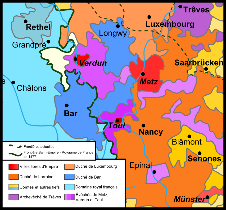
English: Map of Lorraine ad its confines in the 15th century. Français : Carte de la Lorraine au XVe siècle. |
| Date | |
| Source |
Own work Morceau de carte extrait de  |
| Author | JuJu939 |
Licensing edit
I, the copyright holder of this work, hereby publish it under the following license:
This file is licensed under the Creative Commons Attribution-Share Alike 3.0 Unported license.
- You are free:
- to share – to copy, distribute and transmit the work
- to remix – to adapt the work
- Under the following conditions:
- attribution – You must give appropriate credit, provide a link to the license, and indicate if changes were made. You may do so in any reasonable manner, but not in any way that suggests the licensor endorses you or your use.
- share alike – If you remix, transform, or build upon the material, you must distribute your contributions under the same or compatible license as the original.
File history
Click on a date/time to view the file as it appeared at that time.
| Date/Time | Thumbnail | Dimensions | User | Comment | |
|---|---|---|---|---|---|
| current | 11:26, 8 December 2013 | | 954 × 888 (287 KB) | JuJu939 (talk | contribs) | Cadre affiné, correction Senones capitale du comté de Salm |
| 22:06, 9 November 2013 |  | 1,000 × 893 (272 KB) | JuJu939 (talk | contribs) | User created page with UploadWizard |
You cannot overwrite this file.
File usage on Commons
There are no pages that use this file.
File usage on other wikis
The following other wikis use this file:
- Usage on fr.wikipedia.org
- Usage on id.wikipedia.org
- Usage on nl.wikipedia.org
- Usage on ru.wikipedia.org
- Usage on uk.wikipedia.org