File:Carte Mouriez Cassin.jpg
Size of this preview: 757 × 599 pixels. Other resolutions: 303 × 240 pixels | 606 × 480 pixels | 970 × 768 pixels | 1,280 × 1,013 pixels | 2,560 × 2,027 pixels | 3,563 × 2,821 pixels.
Original file (3,563 × 2,821 pixels, file size: 5 MB, MIME type: image/jpeg)
Captions
Captions
Add a one-line explanation of what this file represents
Summary
edit
| Description |
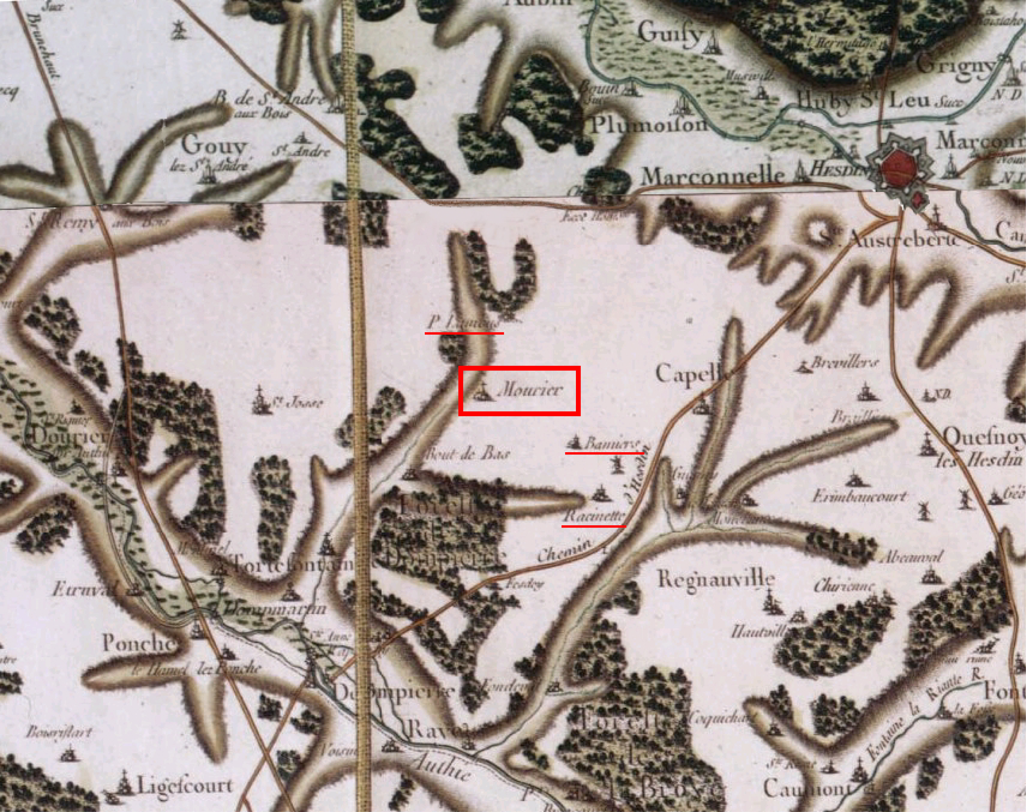
English: Mouriez neighbourhood, portion extracted from Cassini map Abeville-Arras published in 1757.
Français : Alentours de Mouriez, portion extraite de la carte de Cassini Abeville-Arras publiée en 1757. |
| Date | |
| Source | travail personnel (own work) et BNF Gallica |
| Author | Bruno2wi |
| Permission (Reusing this file) |
A partir des cartes de Cassini, libre de de droit cf. http://mappemonde.mgm.fr/num3/internet/int04301.html |
Assemblage et retouches sur bordures
| Camera location | | View this and other nearby images on: OpenStreetMap |
|---|
Licensing
edit
| I, the copyright holder of this work, release this work into the public domain. This applies worldwide. In some countries this may not be legally possible; if so: I grant anyone the right to use this work for any purpose, without any conditions, unless such conditions are required by law. |
File history
Click on a date/time to view the file as it appeared at that time.
| Date/Time | Thumbnail | Dimensions | User | Comment | |
|---|---|---|---|---|---|
| current | 12:44, 8 May 2009 | | 3,563 × 2,821 (5 MB) | Bruno2wi (talk | contribs) | {{Information |Description={{en|1=Mouriez neighbourhood, portion extracted from Cassini map Abeville-Arras published in 1757.}} {{fr|1=Alentours de Mouriez, portion extraite de la carte de Cassini Abeville-Arras publiée en 1757.}} |Source=travail personn |
You cannot overwrite this file.
File usage on Commons
There are no pages that use this file.
File usage on other wikis
The following other wikis use this file:
- Usage on fr.wikipedia.org
- Usage on pcd.wikipedia.org