File:Carte Zianides au Maghreb.png

Size of this preview: 800 × 589 pixels. Other resolutions: 320 × 236 pixels | 640 × 471 pixels | 1,024 × 754 pixels | 1,280 × 943 pixels | 2,560 × 1,886 pixels | 3,179 × 2,342 pixels.
Original file (3,179 × 2,342 pixels, file size: 658 KB, MIME type: image/png)
Captions
Captions
Add a one-line explanation of what this file represents
Summary
edit
| Description |
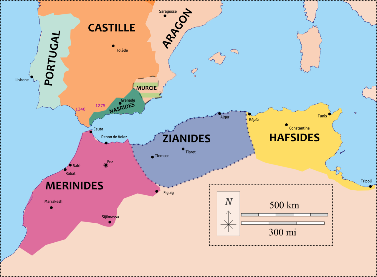
Français : Carte du royaume zianide et son environnement méditerranéen basé sur :
Sluglett, Peter; Currie, Andrew. Atlas of Islamic History (p. 49). Muslim Rule in North Africa and Spain at the End of the Reconquista c.1250–c.1550 et Carte du médieviste Lynn H. Nelson (Professor Emeritus, Medieval History University of Kansas) File:Europe_in_1328.png publiée sur wikimédia |
| Date | |
| Source | Own work |
| Author | Kabyle20 |
Licensing
edit
I, the copyright holder of this work, hereby publish it under the following license:
This file is licensed under the Creative Commons Attribution-Share Alike 4.0 International license.
- You are free:
- to share – to copy, distribute and transmit the work
- to remix – to adapt the work
- Under the following conditions:
- attribution – You must give appropriate credit, provide a link to the license, and indicate if changes were made. You may do so in any reasonable manner, but not in any way that suggests the licensor endorses you or your use.
- share alike – If you remix, transform, or build upon the material, you must distribute your contributions under the same or compatible license as the original.
File history
Click on a date/time to view the file as it appeared at that time.
| Date/Time | Thumbnail | Dimensions | User | Comment | |
|---|---|---|---|---|---|
| current | 15:10, 7 February 2022 | | 3,179 × 2,342 (658 KB) | Monsieur Patillo (talk | contribs) | Uploaded own work with UploadWizard |
You cannot overwrite this file.
File usage on Commons
There are no pages that use this file.
File usage on other wikis
The following other wikis use this file:
- Usage on fr.wikipedia.org