File:Carte du Caucase - L. Robelin del. - btv1b53063429g.jpg

Size of this preview: 800 × 518 pixels. Other resolutions: 320 × 207 pixels | 640 × 414 pixels | 1,024 × 663 pixels | 1,280 × 829 pixels | 2,560 × 1,658 pixels | 8,920 × 5,776 pixels.
Original file (8,920 × 5,776 pixels, file size: 6.32 MB, MIME type: image/jpeg)
Captions
Captions
Add a one-line explanation of what this file represents
Summary edit
| Warning | The original file is very high-resolution. It might not load properly or could cause your browser to freeze when opened at full size. |
|---|
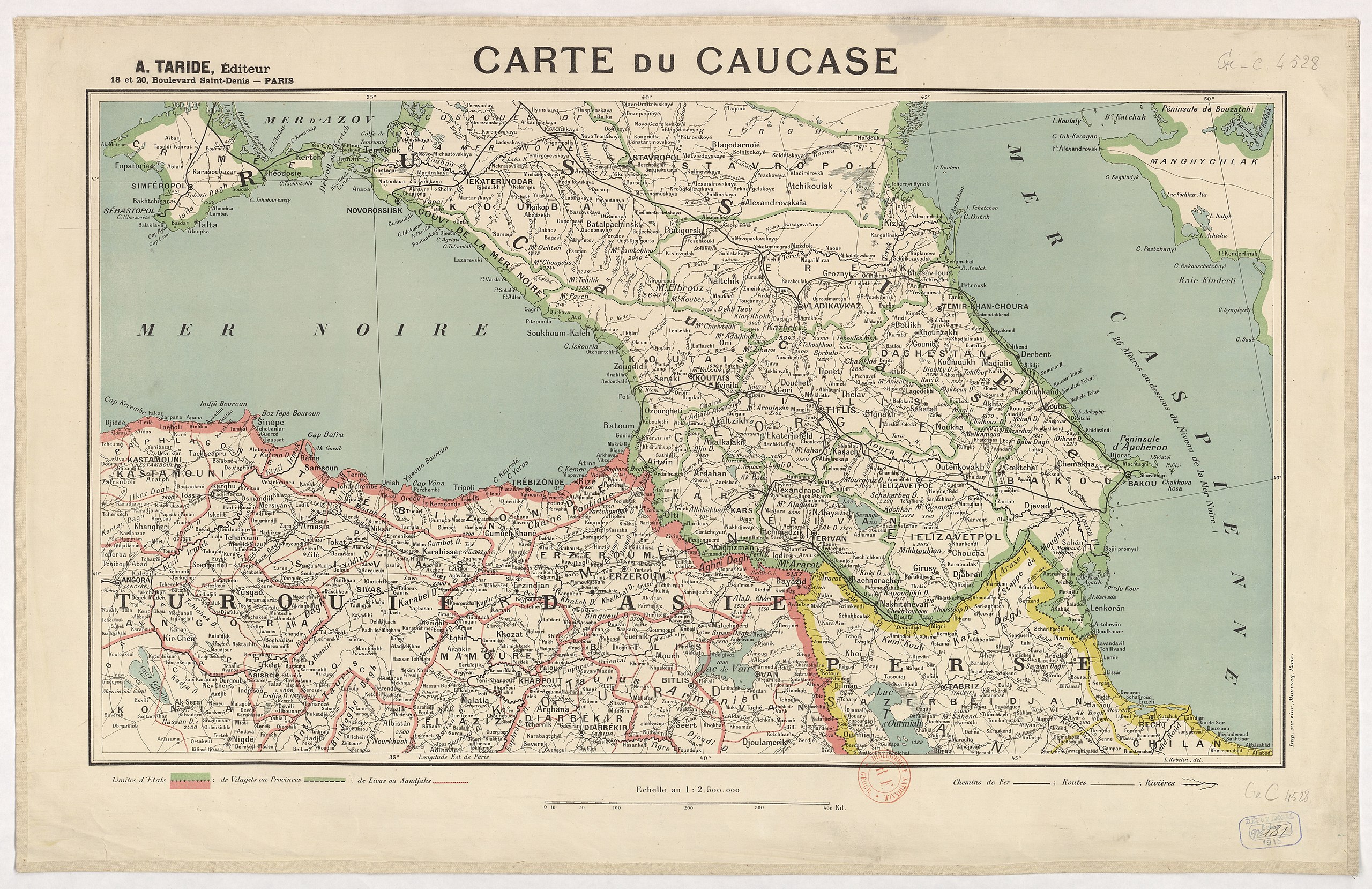
| Carte du Caucase / L. Robelin del.
( |
|||||||||||||||||||||||||||
|---|---|---|---|---|---|---|---|---|---|---|---|---|---|---|---|---|---|---|---|---|---|---|---|---|---|---|---|
| Author |
Robelin, L. (18..-19..? ; lithographe). Cartographe A. Taride (Paris). Auteur du texte |
||||||||||||||||||||||||||
| Title |
Carte du Caucase / L. Robelin del. |
||||||||||||||||||||||||||
| Description |
Français : Sujet : Caucase
Échelle(s) : 1:2 500 000 Couverture : Europe (parties) Langue : français Éditeur : A. Taride éd. (Paris) |
||||||||||||||||||||||||||
| Date | 1915 | ||||||||||||||||||||||||||
| Dimensions | height: 74 cm (29.1 in); width: 48 cm (18.8 in) | ||||||||||||||||||||||||||
| Collection |
|
||||||||||||||||||||||||||
| References |
Français : Notice du catalogue : http://catalogue.bnf.fr/ark:/12148/cb40776366b |
||||||||||||||||||||||||||
| Source/Photographer |
Français : Bibliothèque nationale de France, département Cartes et plans, GE C-4528
Bibliothèque nationale de France |
||||||||||||||||||||||||||
| Permission (Reusing this file) |
|
||||||||||||||||||||||||||

File history
Click on a date/time to view the file as it appeared at that time.
| Date/Time | Thumbnail | Dimensions | User | Comment | |
|---|---|---|---|---|---|
| current | 06:21, 22 August 2022 | | 8,920 × 5,776 (6.32 MB) | Gzen92Bot (talk | contribs) | Gallica btv1b53063429g |
You cannot overwrite this file.
File usage on Commons
The following page uses this file: