File:Carte du Congo Belge.png

Size of this preview: 440 × 599 pixels. Other resolutions: 176 × 240 pixels | 353 × 480 pixels | 564 × 768 pixels | 752 × 1,024 pixels | 1,505 × 2,048 pixels | 7,372 × 10,032 pixels.
Original file (7,372 × 10,032 pixels, file size: 99.43 MB, MIME type: image/png)
Captions
Captions
Add a one-line explanation of what this file represents
Summary
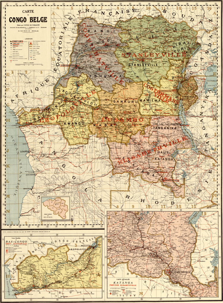
edit| Description |
English: This map is claimed to be from 1896. But that is probably not true. In 1896 neither the “Congo Belge” nor “Tanganyika” existed. Tanganyika was founded in 1919 (treaty of Versailles), thus it seems not to be created before 1919. |
||||
| Date | 1896? But probably after 1919 | ||||
| Source | Library of Congress See also: Library of Congress-Carte du Congo Belge. | ||||
| Author | Bureau de la publicité, J. Lebègue & Cie, Bruxelles | ||||
| Permission (Reusing this file) |
|
||||
| Other versions |
|
||||

File history
Click on a date/time to view the file as it appeared at that time.
| Date/Time | Thumbnail | Dimensions | User | Comment | |
|---|---|---|---|---|---|
| current | 16:28, 15 July 2013 | | 7,372 × 10,032 (99.43 MB) | Chricho (talk | contribs) | {{Information |Description ={{en|1=This map is claimed to be from 1896. But that is probably not true. In 1896 neither the “Congo Belge” nor “Tanganyika” existed. Tanganyika was founded in 1919 (treaty of Versailles), thus it seems not to be... |
You cannot overwrite this file.
File usage on Commons
The following 3 pages use this file:
- File:Belgian Congo.png (file redirect)
- File:Belgian Congo.png.png (file redirect)
- File:Map-belgian-congo.jpg
File usage on other wikis
The following other wikis use this file: