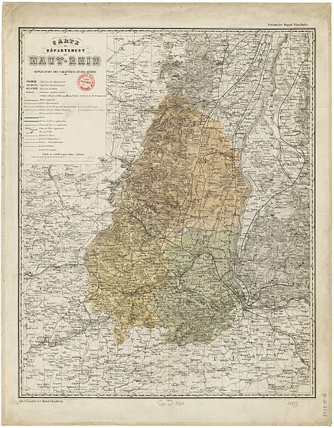
File:Carte du Département du Haut-Rhin 1860.jpg

Original file (4,004 × 5,124 pixels, file size: 35.03 MB, MIME type: image/jpeg)
Captions
Captions
| DescriptionCarte du Département du Haut-Rhin 1860.jpg |
Français : Carte du Département du Haut-Rhin |
||||||
| Date | |||||||
| Source | Carte du Département du Haut-Rhin | ||||||
| Author | Lemaître, E. (18..-18.. ; lithographe). Cartographe ; Munch, Peder Andreas (1810-1863). Cartographe | ||||||
| Permission (Reusing this file) |
|
File history
Click on a date/time to view the file as it appeared at that time.
| Date/Time | Thumbnail | Dimensions | User | Comment | |
|---|---|---|---|---|---|
| current | 06:55, 28 June 2012 |  | 4,004 × 5,124 (35.03 MB) | ComputerHotline (talk | contribs) | {{Information |Description={{fr|Carte du Département du Haut-Rhin}} |Source=[http://gallica.bnf.fr/ark:/12148/btv1b8442111x/f1.zoom Carte du Département du Haut-Rhin] |Date=1860 |Author=Lemaître, E. (18..-18.. ; lithographe). Cartographe ; Munch, Pe... |
You cannot overwrite this file.
File usage on Commons
The following page uses this file:
Metadata
This file contains additional information such as Exif metadata which may have been added by the digital camera, scanner, or software program used to create or digitize it. If the file has been modified from its original state, some details such as the timestamp may not fully reflect those of the original file. The timestamp is only as accurate as the clock in the camera, and it may be completely wrong.
| Image title | Titre : Carte du Département du Haut-Rhin
Auteur : Lemaître, E. (18..-18.. ; lithographe). Cartographe Auteur : Munch, Peder Andreas (1810-1863). Cartographe Éditeur : Lith. E. Lemaître et A. Münch (Strasbourg) Date d'édition : 1860 Sujet : Haut-Rhin, Département du Type : document cartographique,carte,image fixe Langue : Français Format : 1 flle en coul. ; 46 x 61 cm Format : image/jpeg Droits : domaine public Identifiant : ark:/12148/btv1b8442111x Source : Bibliothèque nationale de France, GED-3301 Relation : http://catalogue.bnf.fr/ark:/12148/cb40631010p Couverture : France – Alsace – Haut-Rhin Description : Échelle(s) : 1:250.000 Provenance : bnf.fr |
|---|---|
| JPEG file comment | Created with GIMP |