File:Carte du diocèse d'Auxerre.jpg

Size of this preview: 780 × 600 pixels. Other resolutions: 312 × 240 pixels | 624 × 480 pixels | 999 × 768 pixels | 1,174 × 903 pixels.
Original file (1,174 × 903 pixels, file size: 848 KB, MIME type: image/jpeg)
Captions
Captions
Add a one-line explanation of what this file represents
Summary edit
| Description |
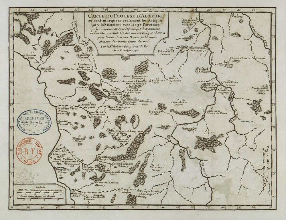
Français : Map of the diocese of Auxerre in the second half of the 6th century, at the time of Aunaire (bishop of Auxerre 573-603), showing all the parishes and all the religious establishments of the time in Auxerre diocèse. Map made in 1741 by "Robert, King's geographer" ; reproduced in abbot Alexandre Parat's book Mémoires concernant l’histoire ecclésiastique et civile d’Auxerre, vol. 1, 1743, p. 117 (the link only provides a partial view of the map). Français : Carte établie par "Sr Robert, géographe ordinaire du Roi", reproduite dans le livre de l'abbé Parat, Mémoires concernant l’histoire ecclésiastique et civile d’Auxerre, vol. 1, 1743, p. 117 (vue partielle dans ce lien). Inscription du cartouche de la carte : Carte du diocèse d'Auxerre où sont marquées seulement les Abbayes qui y subsistaient avec les 37 Paroisses qui le composaient sous l'Episcopat de St Aunaire en l'an 580 suivant l'Ordre que cet Evêque observa pour l'indication des Prières publiques chacun des trente jours du mois - Par le Sr Robert, géo. ordinaire du Roi - Avec Privilège 1741. |
| Date | |
| Source | http://www.cartocassini.org/galerie/picture.php?/683/search/3958 |
| Author | Sr Robert géographe ordinaire du Roi |
Licensing edit
|
This work is in the public domain in its country of origin and other countries and areas where the copyright term is the author's life plus 100 years or fewer. | |
| This file has been identified as being free of known restrictions under copyright law, including all related and neighboring rights. | |
File history
Click on a date/time to view the file as it appeared at that time.
| Date/Time | Thumbnail | Dimensions | User | Comment | |
|---|---|---|---|---|---|
| current | 21:35, 11 November 2008 | | 1,174 × 903 (848 KB) | Patrick89 (talk | contribs) | erreur de carte |
| 21:32, 11 November 2008 |  | 670 × 804 (352 KB) | Patrick89 (talk | contribs) | == Description == {{Information |Description={{fr|1=Carte du diocèse d'Auxerre }} |Source=http://www.cartocassini.org/galerie/picture.php?/683/search/3958 |Author=Sr Robert géographe ordinaire du Roi |Date=1741 |Permission= |other_versions= }} <!--{{Im |
You cannot overwrite this file.
File usage on Commons
There are no pages that use this file.
File usage on other wikis
The following other wikis use this file:
- Usage on ca.wikipedia.org
- Usage on fr.wikipedia.org
- Usage on it.wikipedia.org
- Usage on ru.wikipedia.org
- Usage on uk.wikipedia.org