File:Carte géologique du département de la Savoie - 1869.jpg

Size of this preview: 800 × 571 pixels. Other resolutions: 320 × 228 pixels | 640 × 457 pixels | 1,024 × 731 pixels | 1,280 × 913 pixels | 2,560 × 1,827 pixels | 9,980 × 7,122 pixels.
Original file (9,980 × 7,122 pixels, file size: 17.57 MB, MIME type: image/jpeg)
Captions
Captions
Add a one-line explanation of what this file represents
Summary edit
| Description |
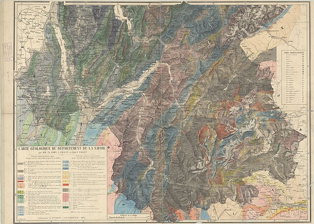
Français : Carte géologique du département de la Savoie English: Map of Savoie |
| Date | |
| Source | https://media.hal.science/medihal-01026250v1 |
| Author | Charles Lory, Louis Pillet, Pierre Vallet, A. Perrin |
Licensing edit
|
This work is in the public domain in its country of origin and other countries and areas where the copyright term is the author's life plus 70 years or fewer. This work is in the public domain in the United States because it was published (or registered with the U.S. Copyright Office) before January 1, 1929. | |
| This file has been identified as being free of known restrictions under copyright law, including all related and neighboring rights. | |
| This file was uploaded as part of Wiki Science Competition 2023. |
File history
Click on a date/time to view the file as it appeared at that time.
| Date/Time | Thumbnail | Dimensions | User | Comment | |
|---|---|---|---|---|---|
| current | 14:03, 3 November 2023 | | 9,980 × 7,122 (17.57 MB) | Pyb en résidence (talk | contribs) | Uploaded own work with UploadWizard |
You cannot overwrite this file.
File usage on Commons
There are no pages that use this file.