File:Carte oran2 Mona.jpg
Carte_oran2_Mona.jpg (300 × 288 pixels, file size: 106 KB, MIME type: image/jpeg)
Captions
Captions
| DescriptionCarte oran2 Mona.jpg |
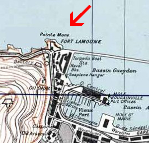
Français : Plan de Oran et sa région English: Town Plan of Oran in Algeria, 1942 |
| Date | (UTC) |
| Source | cropped version of Carte_oran2.jpg |
| Author |
|
| This is a retouched picture, which means that it has been digitally altered from its original version. Modifications: situation de la Mona. The original can be viewed here: Carte oran2.jpg:
|
| Public domainPublic domainfalsefalse |
This file is a work of a U.S. Army soldier or employee, taken or made as part of that person's official duties. As a work of the U.S. federal government, it is in the public domain in the United States.
العربية ∙ বাংলা ∙ català ∙ čeština ∙ Deutsch ∙ English ∙ español ∙ eesti ∙ فارسی ∙ suomi ∙ français ∙ hrvatski ∙ magyar ∙ Bahasa Indonesia ∙ italiano ∙ 日本語 ∙ 한국어 ∙ lietuvių ∙ македонски ∙ മലയാളം ∙ မြန်မာဘာသာ ∙ Nederlands ∙ polski ∙ português ∙ русский ∙ sicilianu ∙ српски / srpski ∙ Türkçe ∙ українська ∙ Tiếng Việt ∙ 中文(简体) ∙ 中文(繁體) ∙ +/− |
 |
Original upload log
editThis image is a derivative work of the following images:
- File:Carte_oran2.jpg licensed with PD-USGov-Military-Army, PD-USGov-Military-Army/fr
- 2009-10-29T08:04:46Z File Upload Bot (Magnus Manske) 1880x1512 (1072284 Bytes) {{BotMoveToCommons|fr.wikipedia|year={{subst:CURRENTYEAR}}|month={{subst:CURRENTMONTHNAME}}|day={{subst:CURRENTDAY}}}} {{Information |Description={{fr|{{Information |Description = |Source = cropped verison of Carte militai
Uploaded with derivativeFX
|
According to article 50 of the Algerian copyright law, it shall be lawful to reproduce or to communicate to the public, without authorization of the author and without remuneration, a work of architecture or the fine arts, a work of applied arts or a photographic work that is permanently situated in a public place, with the exception of art galleries, museums and classified cultural or natural sites.
See COM:CRT/Algeria#Freedom of panorama for more information.
|
File history
Click on a date/time to view the file as it appeared at that time.
| Date/Time | Thumbnail | Dimensions | User | Comment | |
|---|---|---|---|---|---|
| current | 08:21, 8 November 2009 |  | 300 × 288 (106 KB) | Égoïté (talk | contribs) | {{Information |Description={{fr|Plan de Oran et sa région}} {{en|Town Plan of Oran in Algeria, 1942}} |Source=*File:Carte_oran2.jpg |Date=2009-11-08 08:01 (UTC) |Author=*File:Carte_oran2.jpg: War Office (US War Service, US army). *derivative |
You cannot overwrite this file.
File usage on Commons
There are no pages that use this file.
File usage on other wikis
The following other wikis use this file:
- Usage on fr.wikipedia.org
- Usage on incubator.wikimedia.org
Metadata
This file contains additional information such as Exif metadata which may have been added by the digital camera, scanner, or software program used to create or digitize it. If the file has been modified from its original state, some details such as the timestamp may not fully reflect those of the original file. The timestamp is only as accurate as the clock in the camera, and it may be completely wrong.
| Orientation | Normal |
|---|---|
| Horizontal resolution | 300 dpi |
| Vertical resolution | 300 dpi |
| Software used | Adobe Photoshop CS3 Windows |
| File change date and time | 08:58, 8 November 2009 |
| Color space | Uncalibrated |
