File:Carte routière et administrative du département de l'Aveyron (partie sud) - 1856.jpg

Size of this preview: 800 × 478 pixels. Other resolutions: 320 × 191 pixels | 640 × 382 pixels | 1,024 × 612 pixels | 1,280 × 764 pixels | 2,560 × 1,529 pixels | 12,152 × 7,257 pixels.
Original file (12,152 × 7,257 pixels, file size: 13.45 MB, MIME type: image/jpeg)
Captions
Captions
Add a one-line explanation of what this file represents
Summary edit
_-_1856.jpg&action=edit§ion=1)
| Warning | The original file is very high-resolution. It might not load properly or could cause your browser to freeze when opened at full size. |
|---|
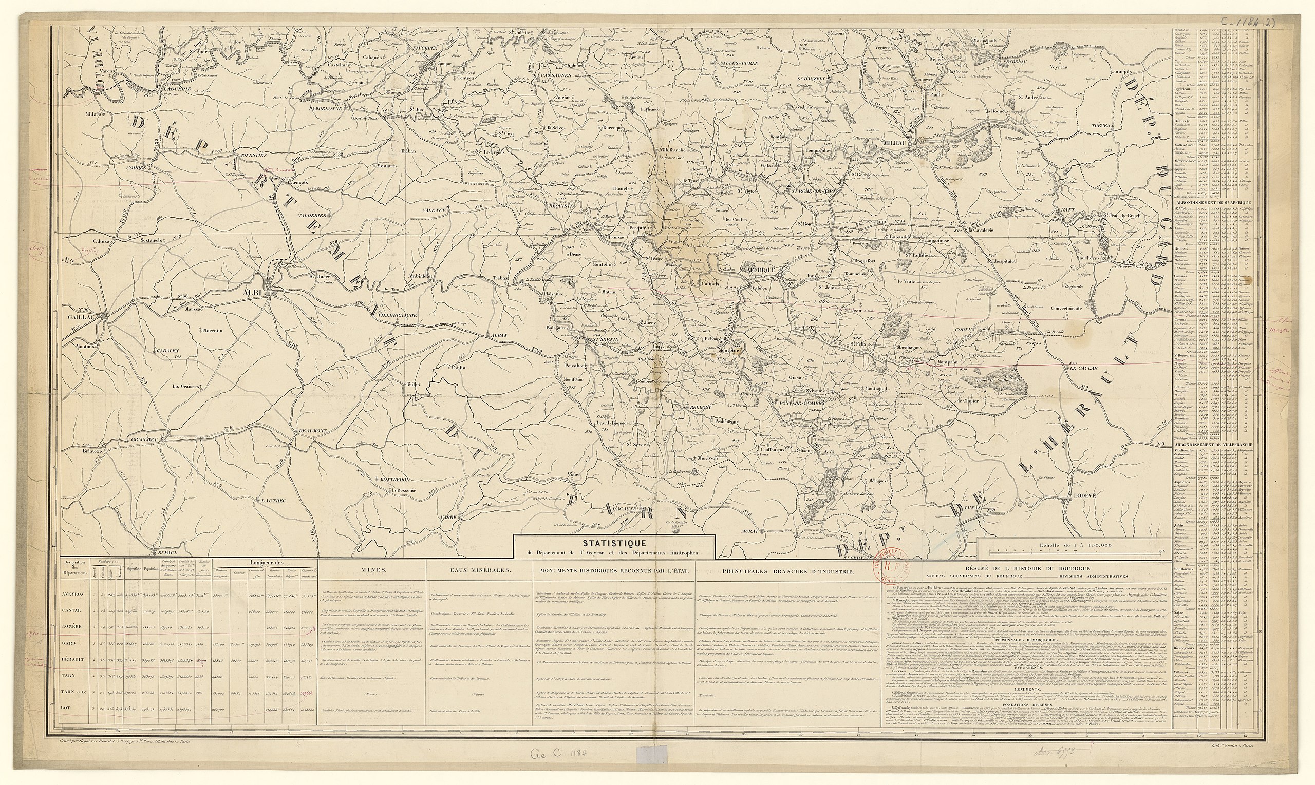
| Description |
Français : Carte routière et administrative du département de l'Aveyron La carte est en deux parties. Ici, c'est la partie sud. Pour la partie nord, voir File:Carte routière et administrative du département de l'Aveyron (partie nord) - 1856.jpg |
||
| Date | |||
| Source |
|
||
| Author | Gustave Cassanac |
_-_1856.jpg)
Licensing edit
_-_1856.jpg&action=edit§ion=2)
|
This work is in the public domain in its country of origin and other countries and areas where the copyright term is the author's life plus 70 years or fewer. This work is in the public domain in the United States because it was published (or registered with the U.S. Copyright Office) before January 1, 1929. | |
| This file has been identified as being free of known restrictions under copyright law, including all related and neighboring rights. | |
File history
Click on a date/time to view the file as it appeared at that time.
| Date/Time | Thumbnail | Dimensions | User | Comment | |
|---|---|---|---|---|---|
| current | 14:48, 22 November 2016 | | 12,152 × 7,257 (13.45 MB) | Gz260 (talk | contribs) | User created page with UploadWizard |
You cannot overwrite this file.
File usage on Commons
The following page uses this file:
File usage on other wikis
The following other wikis use this file:
- Usage on fr.wikipedia.org
_-_1856.jpg&oldid=849345310)