File:Cartographie de la CCBA.png
Size of this preview: 600 × 599 pixels. Other resolutions: 240 × 240 pixels | 481 × 480 pixels | 894 × 893 pixels.
Original file (894 × 893 pixels, file size: 1.59 MB, MIME type: image/png)
Captions
Captions
Add a one-line explanation of what this file represents
Summary
edit
| Description |
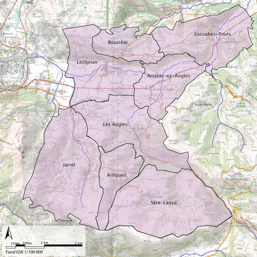
Français : Cartographie de la Communauté de communes de la Baronnie des Angles établie sur un fond de carte |
| Date | |
| Source | Own work |
| Author | Roland Darré |
Licensing
edit
| I, the copyright holder of this work, release this work into the public domain. This applies worldwide. In some countries this may not be legally possible; if so: I grant anyone the right to use this work for any purpose, without any conditions, unless such conditions are required by law. |
File history
Click on a date/time to view the file as it appeared at that time.
| Date/Time | Thumbnail | Dimensions | User | Comment | |
|---|---|---|---|---|---|
| current | 17:41, 31 May 2009 | | 894 × 893 (1.59 MB) | Darreenvt (talk | contribs) | {{Information |Description={{fr|1=Cartographie de la Communauté de communes de la Baronnie des Angles établie sur un fond de carte}} |Source=travail personnel (own work) |Author=Darreenvt |Date=mars 2009 |Permission= |other_versions= |
You cannot overwrite this file.
File usage on Commons
There are no pages that use this file.
File usage on other wikis
The following other wikis use this file:
- Usage on fr.wikipedia.org