File:Cartouche in a Martinica map by Lopez.jpg

Size of this preview: 633 × 600 pixels. Other resolutions: 253 × 240 pixels | 507 × 480 pixels | 810 × 768 pixels | 1,081 × 1,024 pixels | 1,394 × 1,321 pixels.
Original file (1,394 × 1,321 pixels, file size: 272 KB, MIME type: image/jpeg)
Captions
Captions
Add a one-line explanation of what this file represents
Summary
edit| Description |
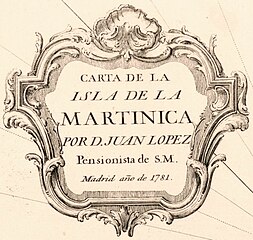
English: Scale ca. 1:250,000. Hand colored. Relief shown by hachures. Includes history note. LC Maps of North America, 1750-1789, 2065 Available also through the Library of Congress Web site as a raster image. Vault AACR2 |
||
| Title | Carta de la isla de la Martinica | ||
| Shelf ID | G5080 1781 .L6 | ||
| Date | |||
| Source | https://www.loc.gov/item/74691153/ | ||
| Author | López, Juan | ||
| Permission (Reusing this file) |
|
||
| Other versions |
|
||
| Location | Martinique. · Martinique | ||
| Part of | Military Battles And Campaigns · American Memory · Catalog · Geography And Map Division · American Revolution And Its Era: Maps And Charts Of North America And The West Indies, 1750-1789 | ||
| Subject | Maps · Early Works To 1800 · Martinique |


Licensing
edit
|
This is a faithful photographic reproduction of a two-dimensional, public domain work of art. The work of art itself is in the public domain for the following reason:
The official position taken by the Wikimedia Foundation is that "faithful reproductions of two-dimensional public domain works of art are public domain".
This photographic reproduction is therefore also considered to be in the public domain in the United States. In other jurisdictions, re-use of this content may be restricted; see Reuse of PD-Art photographs for details. | ||||
File history
Click on a date/time to view the file as it appeared at that time.
| Date/Time | Thumbnail | Dimensions | User | Comment | |
|---|---|---|---|---|---|
| current | 17:58, 26 August 2023 | | 1,394 × 1,321 (272 KB) | Enyavar (talk | contribs) | File:Carta de la isla de la Martinica LOC 74691153.jpg cropped 74 % horizontally, 73 % vertically, rotated 0.8° using CropTool with precise mode. |
You cannot overwrite this file.
File usage on Commons
The following page uses this file: