File:Castello di Montfleury mappa Catasto Francese 1804 Mont6.jpeg

Size of this preview: 800 × 556 pixels. Other resolutions: 320 × 223 pixels | 640 × 445 pixels | 1,024 × 712 pixels | 1,280 × 890 pixels | 2,432 × 1,691 pixels.
Original file (2,432 × 1,691 pixels, file size: 1.97 MB, MIME type: image/jpeg)
Captions
Captions
Add a one-line explanation of what this file represents
Summary edit
| Description |
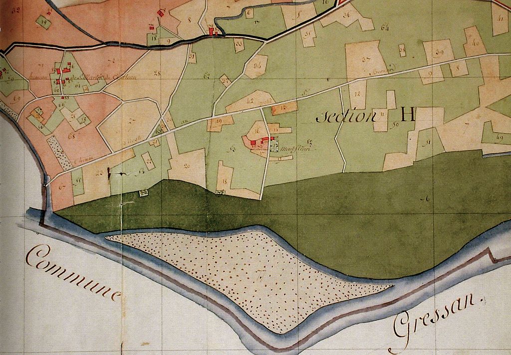
Italiano: Particolare della mappa del Catasto Francese per masse di coltura del 1804, "Plan de la Comune d'Aoste, Départ. de la Doire, Arrondissement comunal d'Aoste, Canton D. Terminé le 25 Brumaire an 12 par le C.n Turno Géomètre en Chef et le C.n Margery Arpenteur". Castello di Montfleury, Aosta, Valle d'Aosta, Italia. |
| Date | |
| Source | dettaglio mappa del Catasto Francese del 1804 con Montfleury. Immagine scansionata da Chiara Devoti, Annotazioni storiche e letture di cantiere per il Castello di Montfleury, Aosta: Tipografia Valdostana, 2003, p. 13. |
| Author | C.n Turno Géomètre en Chef et le C.n Margery Arpenteur' |
Licensing edit
|
This work is in the public domain in its country of origin and other countries and areas where the copyright term is the author's life plus 100 years or fewer. | |
| This file has been identified as being free of known restrictions under copyright law, including all related and neighboring rights. | |
File history
Click on a date/time to view the file as it appeared at that time.
| Date/Time | Thumbnail | Dimensions | User | Comment | |
|---|---|---|---|---|---|
| current | 10:45, 3 February 2013 | | 2,432 × 1,691 (1.97 MB) | Rotatebot (talk | contribs) | Bot: Image rotated by 90° |
| 09:52, 3 February 2013 |  | 1,691 × 2,440 (1.98 MB) | Patafisik (talk | contribs) | User created page with UploadWizard |
You cannot overwrite this file.
File usage on Commons
There are no pages that use this file.
File usage on other wikis
The following other wikis use this file:
- Usage on de.wikipedia.org
- Usage on fr.wikipedia.org
- Usage on it.wikipedia.org