File:Castlepoint Lighthouse (9) (32017536365).jpg
Size of this preview: 800 × 251 pixels. Other resolutions: 320 × 100 pixels | 640 × 201 pixels | 2,192 × 688 pixels.
Original file (2,192 × 688 pixels, file size: 445 KB, MIME type: image/jpeg)
Captions
Captions
Add a one-line explanation of what this file represents
Summary edit
_(32017536365).jpg&action=edit§ion=1)
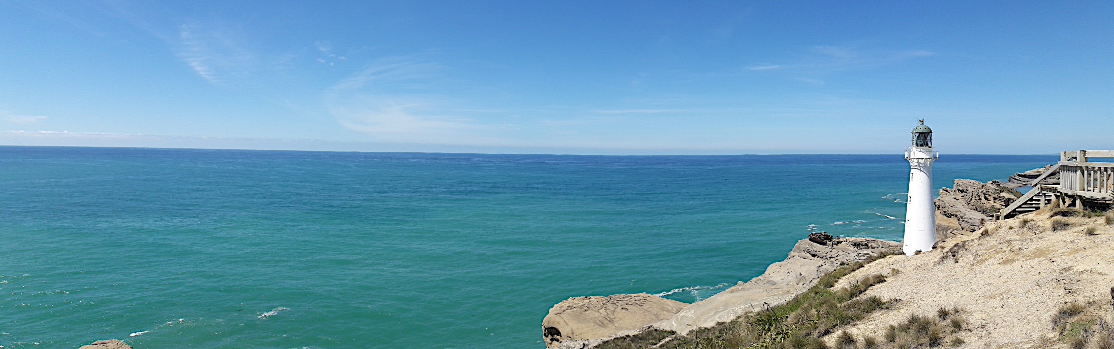
| Description | The Castlepoint Lighthouse is approximately 65 km east of Masterton and a hidden gem to be found after driving on the winding road through farmland. |
| Date | |
| Source | Castlepoint Lighthouse (9) |
| Author | Kristina D.C. Hoeppner from Wellington, New Zealand |
| Camera location | | View this and other nearby images on: OpenStreetMap |
|---|
_(32017536365).jpg¶ms=-40.899445_N_0176.231666_E_globe:Earth_type:camera_source:Flickr_&language=en)
Licensing edit
_(32017536365).jpg&action=edit§ion=2)
This file is licensed under the Creative Commons Attribution-Share Alike 2.0 Generic license.
- You are free:
- to share – to copy, distribute and transmit the work
- to remix – to adapt the work
- Under the following conditions:
- attribution – You must give appropriate credit, provide a link to the license, and indicate if changes were made. You may do so in any reasonable manner, but not in any way that suggests the licensor endorses you or your use.
- share alike – If you remix, transform, or build upon the material, you must distribute your contributions under the same or compatible license as the original.
| This image was originally posted to Flickr by 4nitsirk at https://flickr.com/photos/26223114@N02/32017536365. It was reviewed on 15 December 2020 by FlickreviewR 2 and was confirmed to be licensed under the terms of the cc-by-sa-2.0. |
File history
Click on a date/time to view the file as it appeared at that time.
| Date/Time | Thumbnail | Dimensions | User | Comment | |
|---|---|---|---|---|---|
| current | 15:35, 15 December 2020 | 2,192 × 688 (445 KB) | JotaCartas (talk | contribs) | Transferred from Flickr via #flickr2commons |
You cannot overwrite this file.
File usage on Commons
There are no pages that use this file.
_(32017536365).jpg&oldid=851038218)