File:Castlewood SP Panorama 20090705.jpg
Size of this preview: 800 × 178 pixels. Other resolutions: 320 × 71 pixels | 640 × 142 pixels | 1,024 × 228 pixels | 1,280 × 285 pixels | 7,802 × 1,736 pixels.
Original file (7,802 × 1,736 pixels, file size: 3.07 MB, MIME type: image/jpeg)
Captions
Captions
Add a one-line explanation of what this file represents
Summary
edit
| Description |
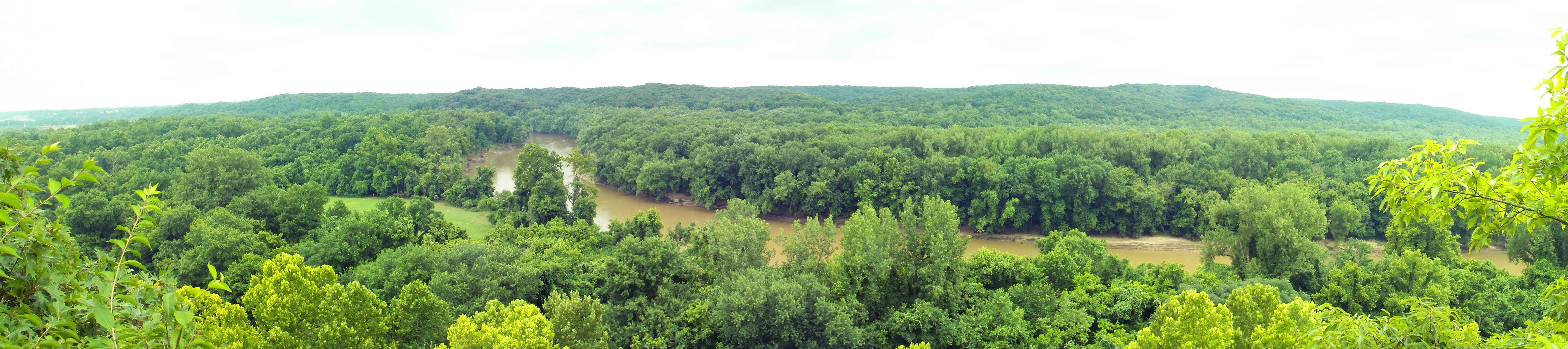
English: A panorama of the Meramec River valley looking toward the south from atop the bluffs at Castlewood State Park in Missouri near St. Louis. The river as shown is higher and muddier than usual for this time of year.
Across the river are more of the same park and Lone Elk County Park. To the west (right) are Tyson Research Center, West Tyson County Park, and Route 66 State Park. These protected areas, along with additional state conservation lands, create a large greenway named the Henry Shaw Ozark Corridor. This image is a composite of 9 images stitched together with hugin (software). It encompasses approximately 130° horizontally. |
| Date | |
| Source | Own work |
| Author | Kbh3rd |
| Other versions | File:Castlewood SP Panorama 20090802.jpg |
| Camera location | | View this and other nearby images on: OpenStreetMap |
|---|
This image was created with Hugin.
]
Licensing
edit
I, the copyright holder of this work, hereby publish it under the following licenses:
This file is licensed under the Creative Commons Attribution-Share Alike 3.0 Unported license.
- You are free:
- to share – to copy, distribute and transmit the work
- to remix – to adapt the work
- Under the following conditions:
- attribution – You must give appropriate credit, provide a link to the license, and indicate if changes were made. You may do so in any reasonable manner, but not in any way that suggests the licensor endorses you or your use.
- share alike – If you remix, transform, or build upon the material, you must distribute your contributions under the same or compatible license as the original.

|
Permission is granted to copy, distribute and/or modify this document under the terms of the GNU Free Documentation License, Version 1.2 or any later version published by the Free Software Foundation; with no Invariant Sections, no Front-Cover Texts, and no Back-Cover Texts. A copy of the license is included in the section entitled GNU Free Documentation License. |
You may select the license of your choice.
File history
Click on a date/time to view the file as it appeared at that time.
| Date/Time | Thumbnail | Dimensions | User | Comment | |
|---|---|---|---|---|---|
| current | 05:56, 6 July 2009 | 7,802 × 1,736 (3.07 MB) | Kbh3rd (talk | contribs) | Recast with a stereographic projections; the original was rectilinear. I think the stereographic is somewhat superior in this application. | |
| 22:45, 5 July 2009 | 8,013 × 1,922 (3.53 MB) | Kbh3rd (talk | contribs) | {{Information |Description={{en|1=A panorama of the Meramec River valley from atop the bluffs at Castlewood State Park in Missouri near St. Louis. The river |
You cannot overwrite this file.
File usage on Commons
There are no pages that use this file.
File usage on other wikis
The following other wikis use this file:
- Usage on en.wikipedia.org