File:Cayo Santiago-chart.png
No higher resolution available.
Cayo_Santiago-chart.png (629 × 460 pixels, file size: 850 KB, MIME type: image/png)
Captions
Captions
Add a one-line explanation of what this file represents
Summary edit
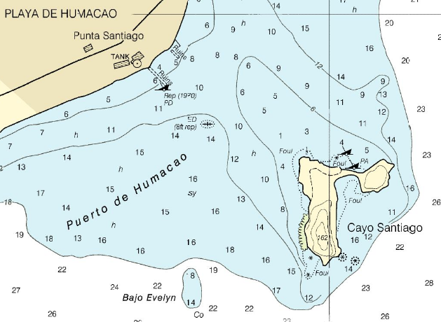
NOAA chart 25665, Punta Lima to Cayo Batata http://www.oceangrafix.com/o.g/Charts/PR_VI/NOAA-Nautical-Chart-Punta-Lima-to-Cayo-Batata.html archive copy at the Wayback Machine
Licensing edit
This image is in the public domain because it contains materials that originally came from the U.S. National Oceanic and Atmospheric Administration, taken or made as part of an employee's official duties.
|
derivative works edit
Derivative works of this file: Visual-fix-by-three-bearings.png
File history
Click on a date/time to view the file as it appeared at that time.
| Date/Time | Thumbnail | Dimensions | User | Comment | |
|---|---|---|---|---|---|
| current | 19:03, 20 January 2008 | | 629 × 460 (850 KB) | Ratzer (talk | contribs) | NOOA chart 25665, Punta Lima to Cayo Batata http://www.oceangrafix.com/o.g/Charts/PR_VI/NOAA-Nautical-Chart-Punta-Lima-to-Cayo-Batata.html |
You cannot overwrite this file.
File usage on Commons
There are no pages that use this file.
File usage on other wikis
The following other wikis use this file:
- Usage on de.wikipedia.org
- Usage on en.wikipedia.org
- Usage on es.wikipedia.org
- Usage on ru.wiktionary.org
- Usage on sv.wikipedia.org
- Usage on www.wikidata.org