File:Central America volcanic belt.jpg

Size of this preview: 800 × 562 pixels. Other resolutions: 320 × 225 pixels | 640 × 449 pixels | 1,024 × 719 pixels | 1,280 × 899 pixels | 2,560 × 1,798 pixels | 4,081 × 2,866 pixels.
Original file (4,081 × 2,866 pixels, file size: 3.02 MB, MIME type: image/jpeg)
Captions
Captions
Add a one-line explanation of what this file represents
| Description |
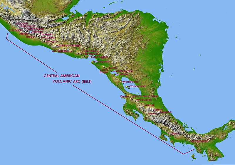
English: Central America in SRTM Shaded Relief and Colored Height |
| Date | (UTC) |
| Source | |
| Author |
|
| This is a retouched picture, which means that it has been digitally altered from its original version. Modifications: Captions of volcanoes in Central America Volcanic Arc. The original can be viewed here: Topographic map of Central America.jpg:
|
| This file is in the public domain in the United States because it was solely created by NASA. NASA copyright policy states that "NASA material is not protected by copyright unless noted". (See Template:PD-USGov, NASA copyright policy page or JPL Image Use Policy.) | ||
 |
Warnings:
|
Original upload log
edit
This image is a derivative work of the following images:
- File:Topographic_map_of_Central_America.jpg licensed with PD-USGov-NASA
- 2010-01-08T15:57:36Z Minor edit 9600x9000 (8603290 Bytes) {{Information |Description={{en|Central America in SRTM Shaded Relief and Colored Height}} |Source=http://photojournal.jpl.nasa.gov/catalog/PIA03364 |Date=2002-10-22 |Author= NASA/JPL/NIMA |Permission={{PD-USGov-NASA}} |other
Uploaded with derivativeFX
File history
Click on a date/time to view the file as it appeared at that time.
| Date/Time | Thumbnail | Dimensions | User | Comment | |
|---|---|---|---|---|---|
| current | 17:20, 6 May 2011 | | 4,081 × 2,866 (3.02 MB) | Judygreenberg (talk | contribs) | {{Information |Description={{en|Central America in SRTM Shaded Relief and Colored Height}} |Source=*File:Topographic_map_of_Central_America.jpg |Date=2011-05-06 17:18 (UTC) |Author=*File:Topographic_map_of_Central_America.jpg: NASA/JPL/NIMA *d |
You cannot overwrite this file.
File usage on Commons
There are no pages that use this file.
File usage on other wikis
The following other wikis use this file:
- Usage on ast.wikipedia.org
- Usage on en.wikipedia.org
- Usage on es.wikipedia.org
- Usage on eu.wikipedia.org
- Usage on fa.wikipedia.org
- Usage on fi.wikipedia.org
- Usage on fr.wikipedia.org
- Mombacho
- Pacaya
- Maderas
- Arenal (volcan)
- Irazú
- Turrialba
- Poás
- Volcán de Agua
- Tajumulco (volcan)
- Barú
- Rota (volcan)
- Santa María (volcan du Guatemala)
- Izalco (volcan)
- Santa Ana (volcan)
- San Salvador (volcan)
- San Vicente (volcan)
- Lac Ilopango
- Momotombo
- Concepción (Nicaragua)
- Masaya (volcan)
- Cosigüina
- Liste des volcans du Nicaragua
- Liste des volcans du Costa Rica
- Volcán de Fuego
- Lac de Coatepeque
- Liste des volcans du Guatemala
- Liste des volcans du Mexique
- Volcan Barva
- Acatenango
- San Cristóbal (volcan)
- San Miguel (volcan)
- Telica
- Orosí
- Miravalles (volcan)
- Rincón de la Vieja
- Platanar
- Tenorio (volcan)
- Almolonga (volcan)
- Ixtepeque
- Volcan Atitlán
- Ipala (volcan)
View more global usage of this file.