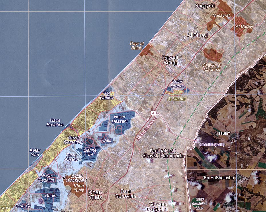
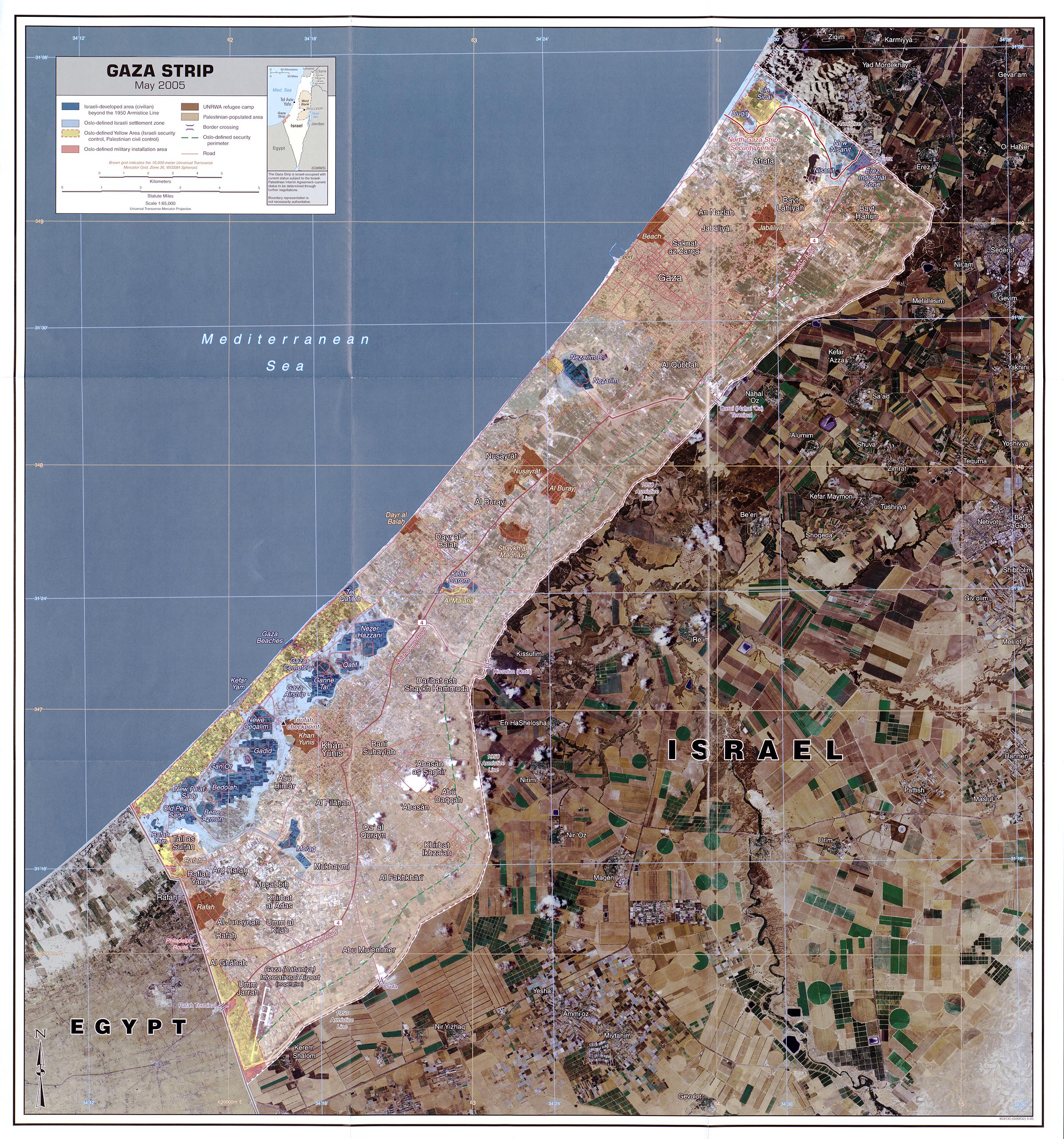
File:Central south, Gaza strip may 2005 (cropped).jpg
Size of this preview: 751 × 600 pixels. Other resolutions: 301 × 240 pixels | 601 × 480 pixels | 928 × 741 pixels.
Original file (928 × 741 pixels, file size: 210 KB, MIME type: image/jpeg)
Captions
Captions
Add a one-line explanation of what this file represents
Summary
editMap is linked from http://www.lib.utexas.edu/maps/gazastrip.html - It says "The following maps were produced by the U.S. Central Intelligence Agency unless otherwise noted."
Map: http://www.lib.utexas.edu/maps/middle_east_and_asia/gaza_strip_may_2005.jpg
Scale 1:65,000

.jpg&action=edit§ion=1)
Licensing
edit.jpg&action=edit§ion=2)
| This work is from the Library of Congress. According to the library, there are no known copyright restrictions on the use of this work. |  |
File history
Click on a date/time to view the file as it appeared at that time.
| Date/Time | Thumbnail | Dimensions | User | Comment | |
|---|---|---|---|---|---|
| current | 18:47, 5 December 2019 | | 928 × 741 (210 KB) | Tibet Nation (talk | contribs) | File:Gaza strip may 2005.jpg cropped 61 % horizontally, 71 % vertically using CropTool with lossless mode. |
You cannot overwrite this file.
File usage on Commons
The following 2 pages use this file:
.jpg&oldid=852608686)