File:Cerulli crater south.jpg

Size of this preview: 800 × 417 pixels. Other resolutions: 320 × 167 pixels | 640 × 333 pixels | 1,024 × 534 pixels | 1,854 × 966 pixels.
Original file (1,854 × 966 pixels, file size: 329 KB, MIME type: image/jpeg)
Captions
Captions
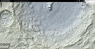
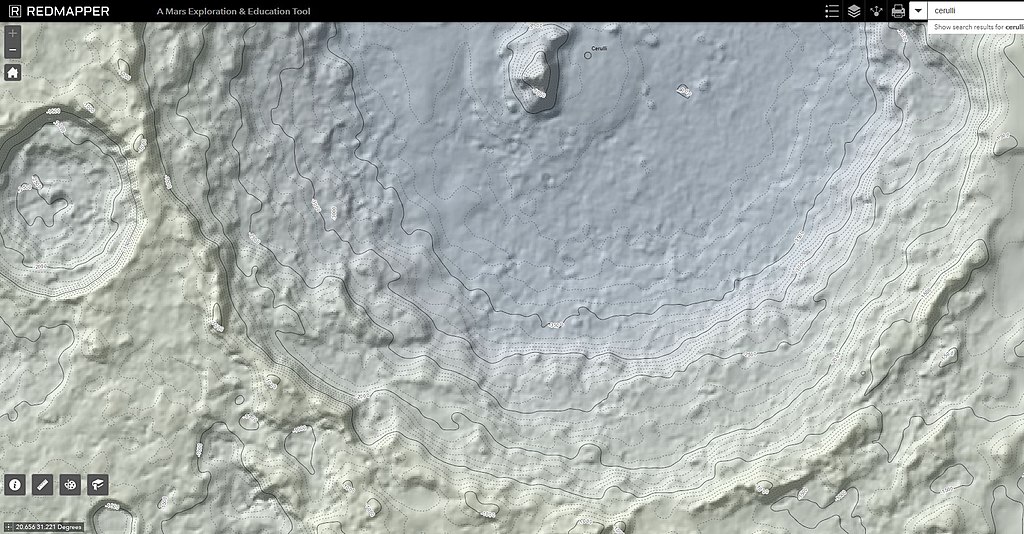
The south rim of the Cerulli crater stands approximately -1000 meters below areoid making it about -500 meters lower than the north rim.
Summary edit
| Description |
English: This topographic map is created using Mars Orbiter Laser Altimeter (MOLA) technology on the Mars Global Surveyor spacecraft. This screenshot of RedMapper's website shows the south rim and the central peak on the Cerulli crater. |
| Date | |
| Source | Own work |
| Author | Mtraynier |
Licensing edit
I, the copyright holder of this work, hereby publish it under the following license:
This file is licensed under the Creative Commons Attribution 4.0 International license.
- You are free:
- to share – to copy, distribute and transmit the work
- to remix – to adapt the work
- Under the following conditions:
- attribution – You must give appropriate credit, provide a link to the license, and indicate if changes were made. You may do so in any reasonable manner, but not in any way that suggests the licensor endorses you or your use.
File history
Click on a date/time to view the file as it appeared at that time.
| Date/Time | Thumbnail | Dimensions | User | Comment | |
|---|---|---|---|---|---|
| current | 19:43, 8 June 2019 | | 1,854 × 966 (329 KB) | Mtraynier (talk | contribs) | User created page with UploadWizard |
You cannot overwrite this file.
File usage on Commons
There are no pages that use this file.