File:Cestats L'Eau Bourde.jpg
No higher resolution available.
Cestats_L'Eau_Bourde.jpg (626 × 516 pixels, file size: 87 KB, MIME type: image/jpeg)
Captions
Captions
Add a one-line explanation of what this file represents
Summary
edit
| Description |
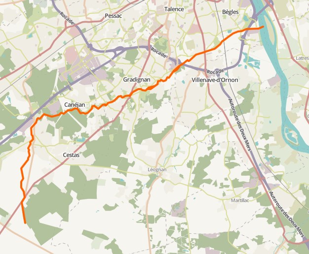
Français : Le tracé du ruisseau l'Eau Bourde de sa source jusqu'à la Garonne |
| Date | |
| Source | OpenStreetMap |
| Author | OpenStreetMap contributors. Tiles courtesy of Humanitarian OpenStreetMap Team |
Licensing
edit
| Description |
This map was created from OpenStreetMap project data, collected by the community. This map may be incomplete, and may contain errors. Don't rely solely on it for navigation. |
|||
| Date | (see file history) | |||
| Source | openstreetmap.org | |||
| Creator |
OpenStreetMap contributors |
|||
| Permission (Reusing this file) |
OpenStreetMap data is available under the Open Database License (details). Standard style map tiles are licensed as ODbL Produced Works.
|
|||
| Georeferencing | If inappropriate please set warp_status = skip to hide. |
File history
Click on a date/time to view the file as it appeared at that time.
| Date/Time | Thumbnail | Dimensions | User | Comment | |
|---|---|---|---|---|---|
| current | 17:38, 7 May 2016 | | 626 × 516 (87 KB) | William Ellison (talk | contribs) | User created page with UploadWizard |
You cannot overwrite this file.
File usage on Commons
There are no pages that use this file.