File:Charles Marville, Urinoir à 1 stalle maconnerie, Cie Drouart Boulevarts Intérieurs, ca. 1865.jpg
Size of this preview: 407 × 599 pixels. Other resolutions: 163 × 240 pixels | 326 × 480 pixels | 521 × 768 pixels | 695 × 1,024 pixels | 1,391 × 2,048 pixels | 3,341 × 4,919 pixels.
Original file (3,341 × 4,919 pixels, file size: 3.71 MB, MIME type: image/jpeg)
Captions
Captions
Add a one-line explanation of what this file represents
Summary edit
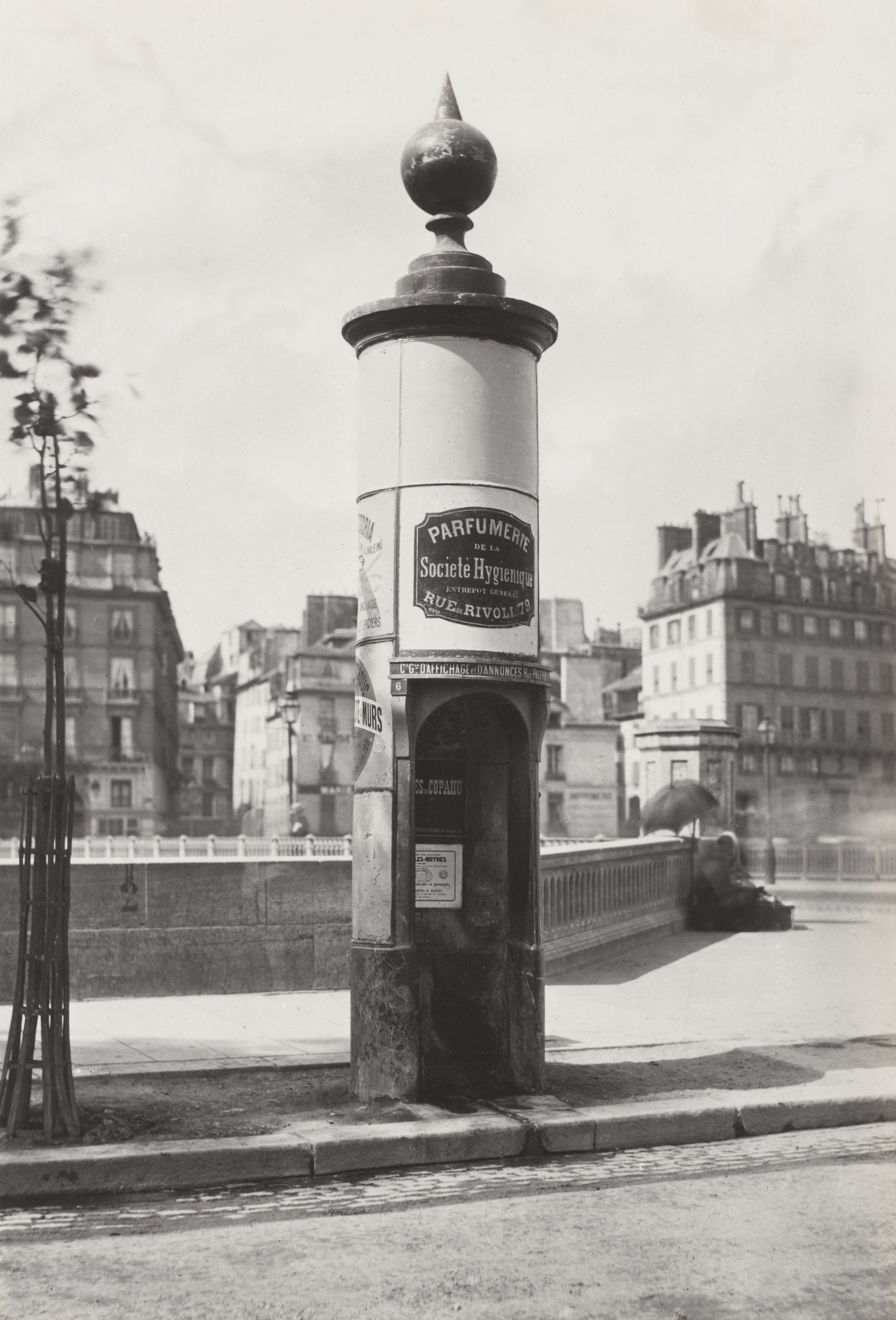
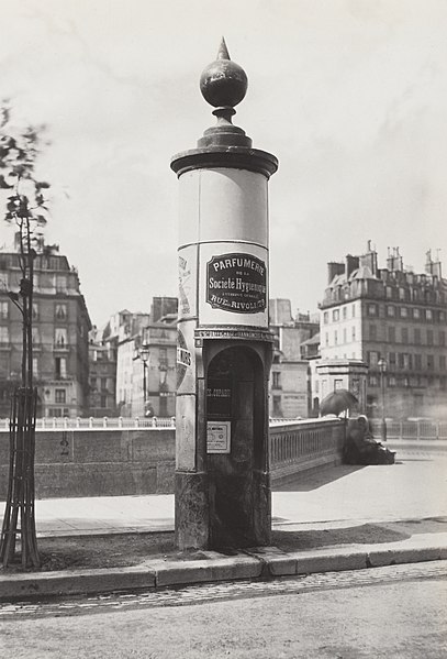
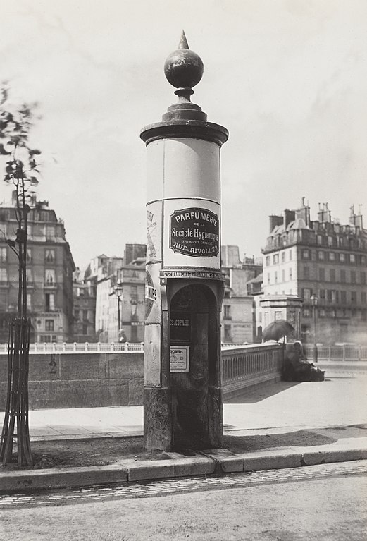
| Charles Marville: Urinoir à 1 stalle maconnerie, Cie Drouart, Bts. [i.e. Boulevarts] Intérieurs.
( |
|||||||||||||||||||||||||||
|---|---|---|---|---|---|---|---|---|---|---|---|---|---|---|---|---|---|---|---|---|---|---|---|---|---|---|---|
| Artist |
|
||||||||||||||||||||||||||
| Title |
Urinoir à 1 stalle maconnerie, Cie Drouart, Bts. [i.e. Boulevarts] Intérieurs. |
||||||||||||||||||||||||||
| Description |
English: Single stall masonry urinal mounted with globe, advertising on sides, on path, balustrade and buildings in background. |
||||||||||||||||||||||||||
| Date | circa 1865 | ||||||||||||||||||||||||||
| Medium | 1 photographic print mounted on cardboard : albumen silver | ||||||||||||||||||||||||||
| Dimensions | height: 34.7 cm (13.6 in); width: 23.5 cm (9.2 in) | ||||||||||||||||||||||||||
| Collection |
|
||||||||||||||||||||||||||
| Accession number |
H2011.126/34 |
||||||||||||||||||||||||||
| Credit line | Gift; Government of France; 1881. | ||||||||||||||||||||||||||
| Inscriptions | Title on contents page: Catégorie K, No. 34: Urinoir à 1 stalle maconnerie, Cie Drouart Boulevarts Intérieurs | ||||||||||||||||||||||||||
| Notes |
Photographer's blind stamp below image. Title printed on slip of paper pasted to album page. Not dated but circa 1865. |
||||||||||||||||||||||||||
| Source/Photographer |
|
||||||||||||||||||||||||||


| Camera location | | View this and other nearby images on: OpenStreetMap |
|---|
Licensing edit
|
This work is in the public domain in its country of origin and other countries and areas where the copyright term is the author's life plus 100 years or fewer. | |
| This file has been identified as being free of known restrictions under copyright law, including all related and neighboring rights. | |
File history
Click on a date/time to view the file as it appeared at that time.
| Date/Time | Thumbnail | Dimensions | User | Comment | |
|---|---|---|---|---|---|
| current | 14:58, 5 December 2013 | | 3,341 × 4,919 (3.71 MB) | Paris 16 (talk | contribs) | |
| 14:56, 5 December 2013 |  | 4,323 × 7,129 (6.24 MB) | Paris 16 (talk | contribs) |
You cannot overwrite this file.
File usage on Commons
The following page uses this file:
File usage on other wikis
The following other wikis use this file:
- Usage on fr.wikibooks.org
- Usage on nl.wikipedia.org