File:Chart of Amphila Bay (plate 10).jpg
Size of this preview: 800 × 582 pixels. Other resolutions: 320 × 233 pixels | 640 × 466 pixels | 1,024 × 745 pixels | 1,327 × 966 pixels.
Original file (1,327 × 966 pixels, file size: 158 KB, MIME type: image/jpeg)
Captions
Captions
Add a one-line explanation of what this file represents
Summary
edit.jpg&action=edit§ion=1)
| Chart of Amphila Bay | |
|---|---|
| Artist |
Drawn by John Outhett, engraved by Alexander Mcpherson, Published by F.C.&J. Rivington, St. Pauls Church Yard, London |
| Author |
Salt, Henry (1780 -1827). Drawn by John Outhett, engraved by Alexander Mcpherson, Published by F.C.&J. Rivington, St. Pauls Church Yard, London |
| Title |
Chart of Amphila Bay |
| Description |
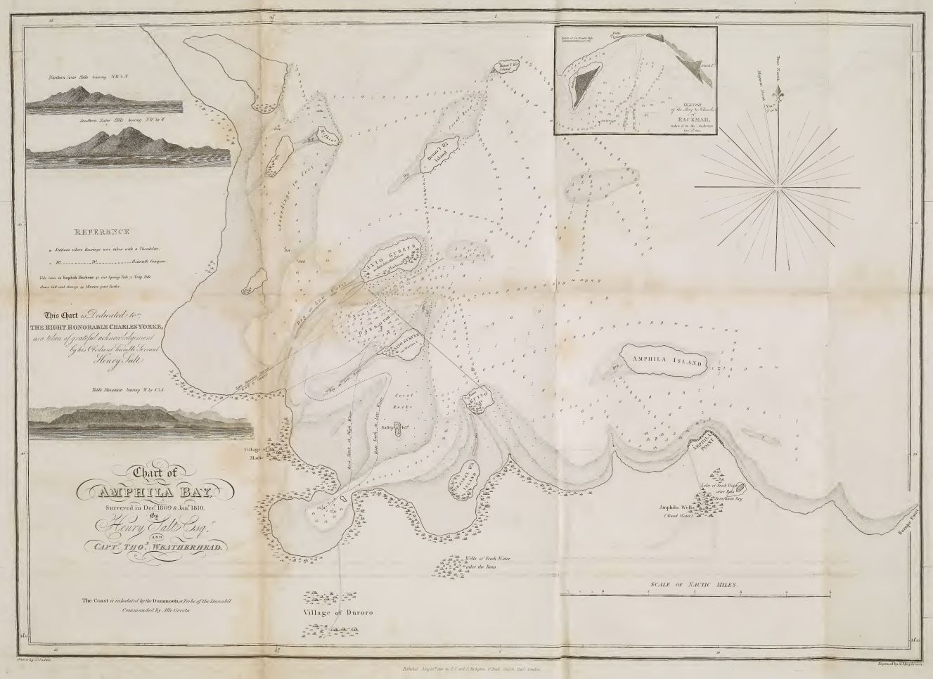
English: Plate 10., facing p. 146. Chart of Amphila Bay. Surveyed in Dec. 1809 & Jan. 1810 by Henry Salt esq., and Capt. Thos. Weatherhead. Drawn by J. Outhett; Engraved by A. Macpherson. Dedicated to Right Honorable Charles Yorke. Mozambique |
| Depicted place | Bay of Anfile |
| Date | 1814 |
| Source/Photographer | |
Licensing
edit.jpg&action=edit§ion=2)
|
This is a faithful photographic reproduction of a two-dimensional, public domain work of art. The work of art itself is in the public domain for the following reason:
The official position taken by the Wikimedia Foundation is that "faithful reproductions of two-dimensional public domain works of art are public domain".
This photographic reproduction is therefore also considered to be in the public domain in the United States. In other jurisdictions, re-use of this content may be restricted; see Reuse of PD-Art photographs for details. | ||||
File history
Click on a date/time to view the file as it appeared at that time.
| Date/Time | Thumbnail | Dimensions | User | Comment | |
|---|---|---|---|---|---|
| current | 09:43, 9 June 2023 | | 1,327 × 966 (158 KB) | Broichmore (talk | contribs) | {{Artwork |artist = Drawn by John Outhett, engraved by Alexander Mcpherson, Published by F.C.&J. Rivington, St. Pauls Church Yard, London |author = Salt, Henry (1780 -1827). Drawn by John Outhett, engraved by Alexander Mcpherson, Published by F.C.&J. Rivington, St. Pauls Church Yard, London |title = Chart of Amphila Bay |description = {{en|1=Chart of Amphila Bay. Surveyed in Dec. 1809 & Jan. 1810 by Henry Salt esq., and Capt. Thos. Weatherhead.... |
You cannot overwrite this file.
File usage on Commons
The following page uses this file:
.jpg)
.jpg&oldid=854788108)