File:Chart of the Canton River.jpg

Size of this preview: 641 × 600 pixels. Other resolutions: 257 × 240 pixels | 513 × 480 pixels | 821 × 768 pixels | 1,095 × 1,024 pixels | 2,484 × 2,324 pixels.
Original file (2,484 × 2,324 pixels, file size: 264 KB, MIME type: image/jpeg)
Captions
Captions
Add a one-line explanation of what this file represents
Summary
edit
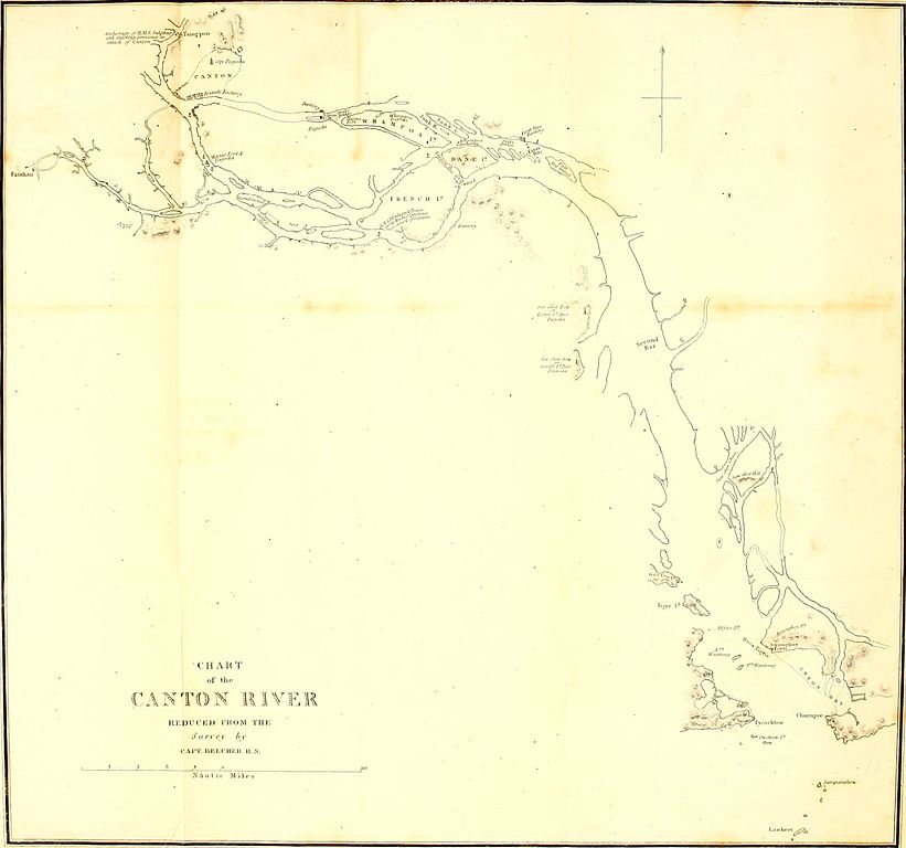
| Description | Chart of the Canton River reduced from the survey by Captain Belcher. |
| Date | published 1843 |
| Source | Edward Belcher (1843). Narrative of a Voyage Round the World. Volume 1. London: Henry Colburn. |
| Author | Edward Belcher |
Licensing
edit
|
This work is in the public domain in its country of origin and other countries and areas where the copyright term is the author's life plus 100 years or fewer. This work is in the public domain in the United States because it was published (or registered with the U.S. Copyright Office) before January 1, 1929. | |
| This file has been identified as being free of known restrictions under copyright law, including all related and neighboring rights. | |
File history
Click on a date/time to view the file as it appeared at that time.
| Date/Time | Thumbnail | Dimensions | User | Comment | |
|---|---|---|---|---|---|
| current | 16:14, 14 August 2010 | | 2,484 × 2,324 (264 KB) | Spellcast (talk | contribs) | == {{int:filedesc}} == {{Information |Description=Chart of the Canton River reduced from the survey by Captain Belcher. |Date=Published 1843 |Source=Edward Belcher (1843). ''[http://www.archive.org/stream/narrativeofvoyag01belc#page/n457 Narrative of a Vo |
You cannot overwrite this file.
File usage on Commons
There are no pages that use this file.
File usage on other wikis
The following other wikis use this file:
- Usage on zh-yue.wikipedia.org